MyTopo
Anadarko NW Oklahoma US Topo Map
Couldn't load pickup availability
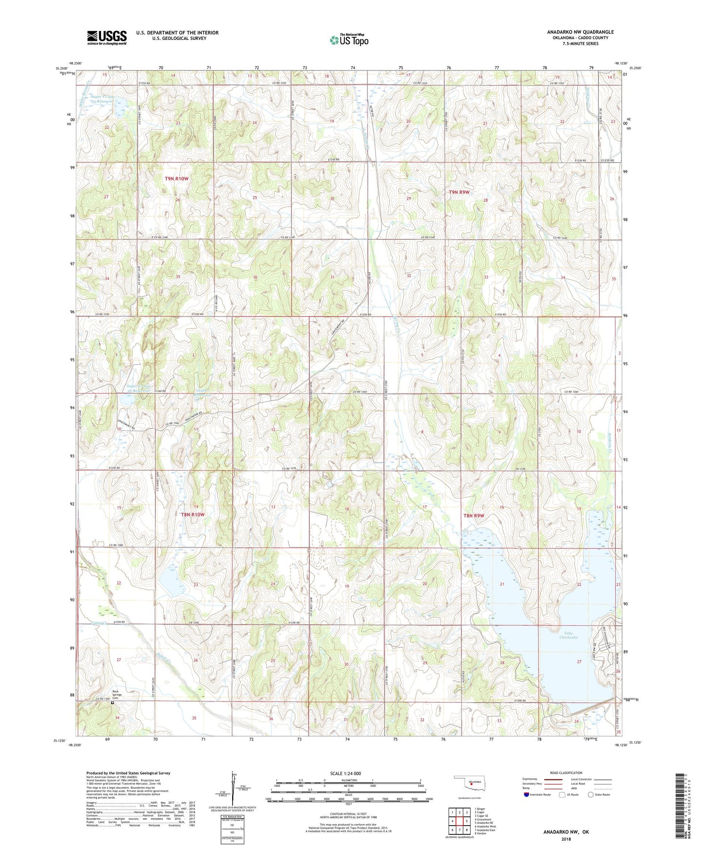
2022 topographic map quadrangle Anadarko NW in the state of Oklahoma. Scale: 1:24000. Based on the newly updated USGS 7.5' US Topo map series, this map is in the following counties: Caddo. The map contains contour data, water features, and other items you are used to seeing on USGS maps, but also has updated roads and other features. This is the next generation of topographic maps. Printed on high-quality waterproof paper with UV fade-resistant inks.
Quads adjacent to this one:
West: Gracemont
Northwest: Binger
North: Cogar
Northeast: Cogar SE
East: Anadarko NE
Southeast: Verden
South: Anadarko East
Southwest: Anadarko West
This map covers the same area as the classic USGS quad with code o35098b2.
Contains the following named places: Anadarko Division, Camp Creek, Lake Chickasha, Lake Chickasha Dam, Oknoname 015017 Dam, Oknoname 015017 Reservoir, Rock Springs Cemetery, Rock Springs Church, Spring Creek Church, Stinking Creek, Sugar Creek Site 33 Dam, Sugar Creek Site 33 Reservoir, Sugar Creek Site 36 Dam, Sugar Creek Site 36 Reservoir, Sugar Creek Site 40 Dam, Sugar Creek Site 40 Reservoir, Township of Jefferson, Township of Lincoln, Wichita Mission, ZIP Code: 73042