MyTopo
Bartlesville SE Oklahoma US Topo Map
Couldn't load pickup availability
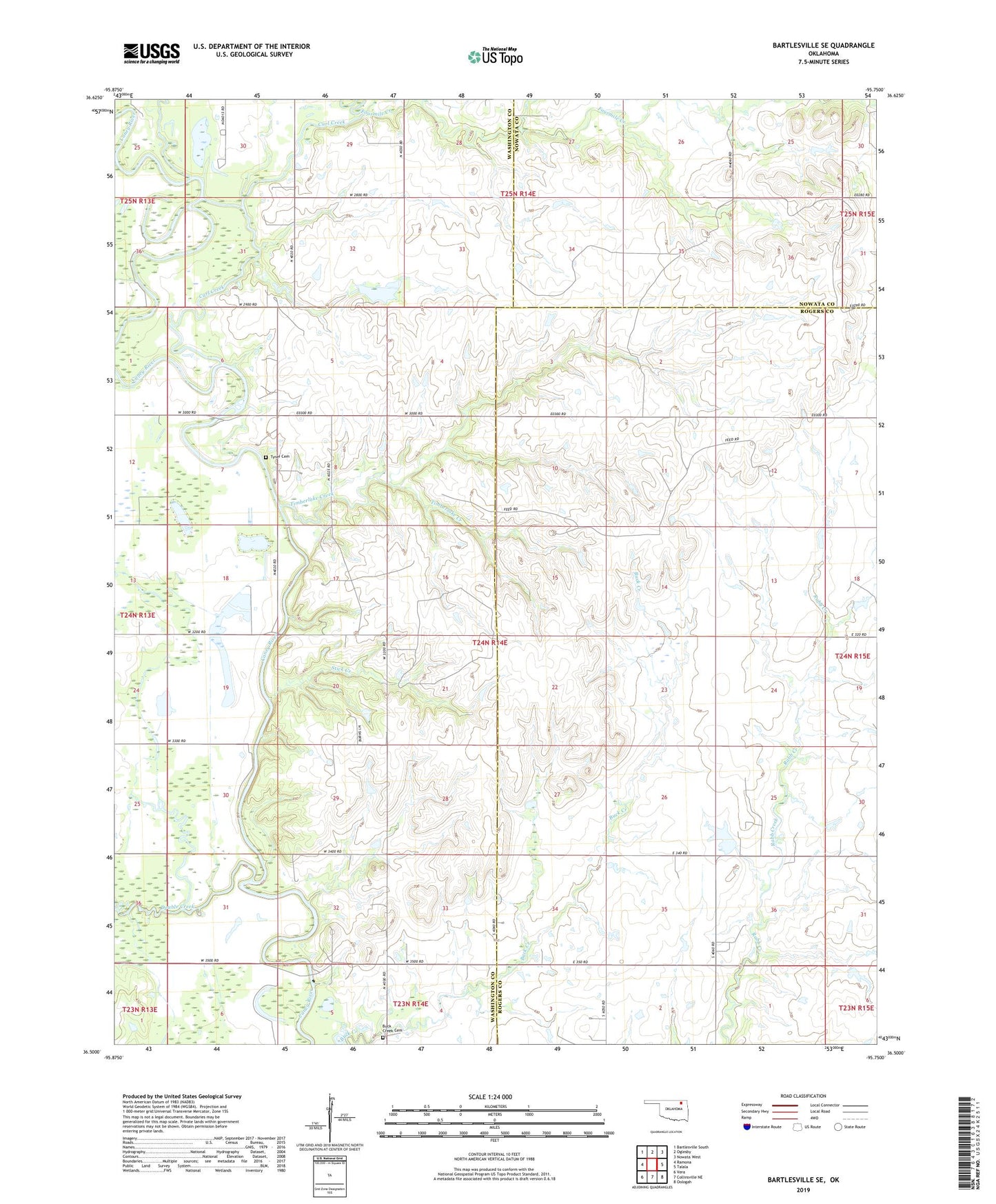
2019 topographic map quadrangle Bartlesville SE in the state of Oklahoma. Scale: 1:24000. Based on the newly updated USGS 7.5' US Topo map series, this map is in the following counties: Washington, Rogers, Nowata. The map contains contour data, water features, and other items you are used to seeing on USGS maps, but also has updated roads and other features. This is the next generation of topographic maps. Printed on high-quality waterproof paper with UV fade-resistant inks.
Quads adjacent to this one:
West: Ramona
Northwest: Bartlesville South
North: Oglesby
Northeast: Nowata West
East: Talala
Southeast: Oologah
South: Collinsville NE
Southwest: Vera
Contains the following named places: Buck Creek Cemetery, Curl Creek, Double Creek, Fourmile Creek, Hogshooter Creek, KDOR-TV (Bartlesville), Stick Creek, Timberlake Creek, Tyner Cemetery, Wagoner Lake, Wagoner Lake Dam