MyTopo
Braggs Oklahoma US Topo Map
Couldn't load pickup availability
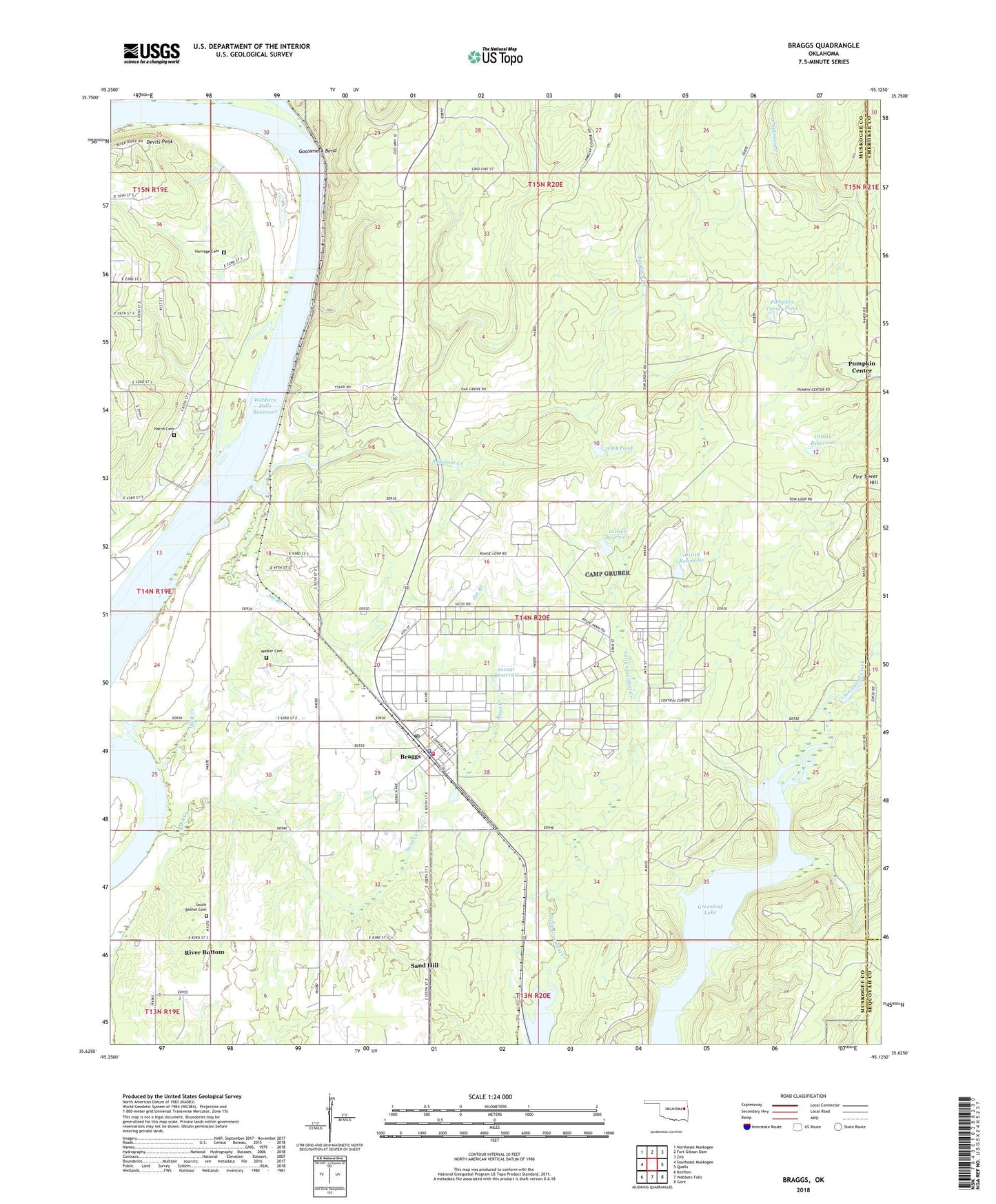
2018 topographic map quadrangle Braggs in the state of Oklahoma. Scale: 1:24000. Based on the newly updated USGS 7.5' US Topo map series, this map is in the following counties: Muskogee, Cherokee, Sequoyah. The map contains contour data, water features, and other items you are used to seeing on USGS maps, but also has updated roads and other features. This is the next generation of topographic maps. Printed on high-quality waterproof paper with UV fade-resistant inks.
Quads adjacent to this one:
West: Southeast Muskogee
Northwest: Northeast Muskogee
North: Fort Gibson Dam
Northeast: Zeb
East: Qualls
Southeast: Gore
South: Webbers Falls
Southwest: Keefton
Contains the following named places: Bayou Manard, Bondinot Creek, Braggs, Braggs High School, Braggs Police Department, Braggs Post Office, Braggs Public School, Braggs Volunteer Fire Department, Camp Gruber, Camp Gruber Heliport, Devils Peak, Gooseneck Bend, Greenleaf Lake, Gruber State Game Management Area, Harnage Cemetery, Harris Cemetery, Hopewell Park Public Use Area, Joe Branch, Little Deep Fork Creek Site 57b Dam, Little Deep Fork Creek Site 57b Reservoir, Oknoname 101018 Dam, Oknoname 101018 Reservoir, Oknoname 101019 Dam, Oknoname 101019 Reservoir, Oknoname 101020 Dam, Oknoname 101020 Reservoir, Oknoname 101021 Dam, Oknoname 101021 Reservoir, Pumpkin Center, Pumpkin Center Pond, Pumpkin Center Pond Dam, River Bottom, River Bottom Census Designated Place, Salt Creek, Sand Creek, Sand Hill, Sand Hill Census Designated Place, Sand Springs Church, South Bethel Cemetery, Star Lake, Town of Braggs, Township of Brewer, Walker Cemetery, WPA Pond, WPA Pond Dam, ZIP Code: 74423