MyTopo
Fort Gibson Dam Oklahoma US Topo Map
Couldn't load pickup availability
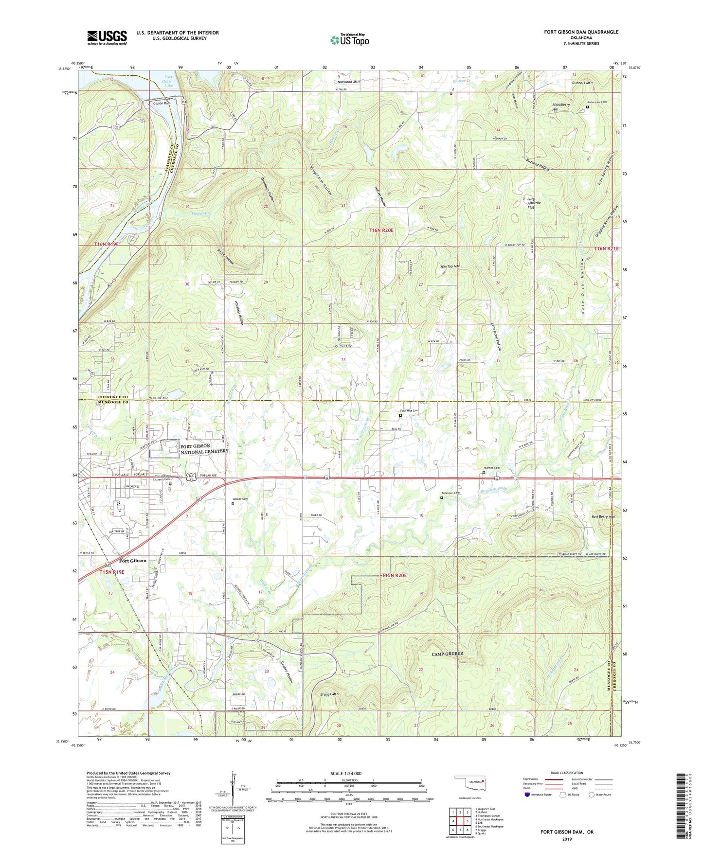
2022 topographic map quadrangle Fort Gibson Dam in the state of Oklahoma. Scale: 1:24000. Based on the newly updated USGS 7.5' US Topo map series, this map is in the following counties: Muskogee, Cherokee, Wagoner. The map contains contour data, water features, and other items you are used to seeing on USGS maps, but also has updated roads and other features. This is the next generation of topographic maps. Printed on high-quality waterproof paper with UV fade-resistant inks.
Quads adjacent to this one:
West: Northeast Muskogee
Northwest: Wagoner East
North: Hulbert
Northeast: Thompson Corner
East: Zeb
Southeast: Qualls
South: Braggs
Southwest: Southeast Muskogee
This map covers the same area as the classic USGS quad with code o35095g2.
Contains the following named places: Anderson Cemetery, Andersons Cemetery, Blackberry Hill, Boughtman Hollow, Braggs Mountain, Buzzard Hollow, Canyon Road Public Use Area, Cedar Hollow, Dam Site Public Use Area, Deadman Hollow, Dripping Spring Hollow, Flower Creek, Fort Gibson Citizen's Cemetery, Fort Gibson Dam, Fort Gibson Early Learning Center, Fort Gibson High School, Fort Gibson Intermediate Elementary School, Fort Gibson Lake, Fort Gibson Middle School, Fort Gibson National Cemetery, Four Mile Cemetery, Fourmile Branch, Fourmile Branch Church, Fourteenmile Creek, Hicks Branch, Iron Spring Hollow, Kale Dick Hollow, Limestone Hollow, Lucy Albirdie Flat, McGee Hollow, Norwood, Norwood Census Designated Place, Norwood Elementary School, Norwood Fire Department Station 1, Norwood Lakeview Church, Runnels Mountain, Sleeper Hollow, Spurlop Mountain, Starnes Cemetery, Sugar Hollow, Township of Nash, Walker Branch, Walker Cemetery, Whiskey Hollow, ZIP Code: 74434