MyTopo
Keefton Oklahoma US Topo Map
Couldn't load pickup availability
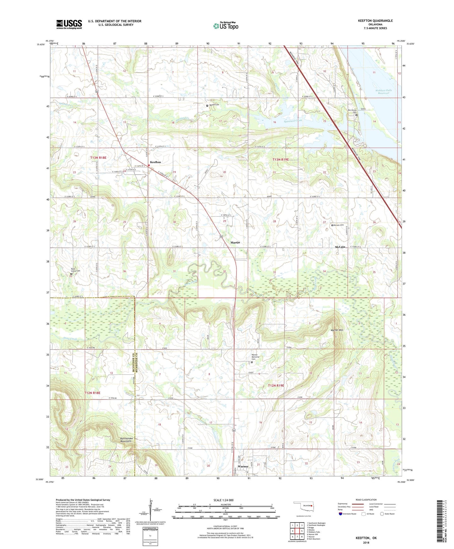
2022 topographic map quadrangle Keefton in the state of Oklahoma. Scale: 1:24000. Based on the newly updated USGS 7.5' US Topo map series, this map is in the following counties: Muskogee, McIntosh. The map contains contour data, water features, and other items you are used to seeing on USGS maps, but also has updated roads and other features. This is the next generation of topographic maps. Printed on high-quality waterproof paper with UV fade-resistant inks.
Quads adjacent to this one:
West: Oktaha
Northwest: Southwest Muskogee
North: Southeast Muskogee
Northeast: Braggs
East: Webbers Falls
Southeast: Holt Mountain
South: Warner
Southwest: Warner NW
This map covers the same area as the classic USGS quad with code o35095e3.
Contains the following named places: Agnew Cemetery, Coal Creek, Elm Grove Cemetery, Elm Grove Church, Keefton, Keefton Census Designated Place, Keefton Volunteer Fire Department, Martin, McLain, McLain Cemetery, Oknoname 101016 Dam, Oknoname 101016 Reservoir, Rock Grove Cemetery, Spaniard Creek Public Use Area, Trinity Church, Warner High School, Warner Memorial Cemetery, Warner Mountain, Webbers Falls Reservoir