MyTopo
Rosston NE Oklahoma US Topo Map
Couldn't load pickup availability
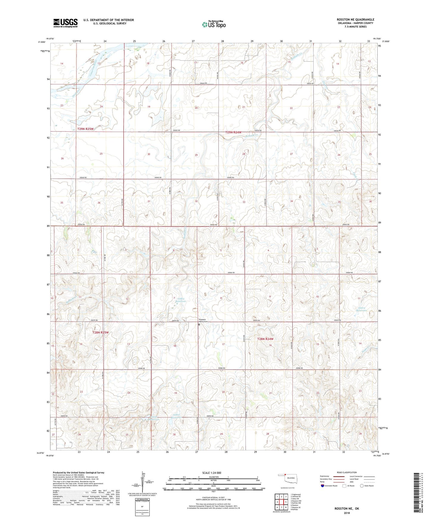
2022 topographic map quadrangle Rosston NE in the state of Oklahoma. Scale: 1:24000. Based on the newly updated USGS 7.5' US Topo map series, this map is in the following counties: Harper. The map contains contour data, water features, and other items you are used to seeing on USGS maps, but also has updated roads and other features. This is the next generation of topographic maps. Printed on high-quality waterproof paper with UV fade-resistant inks.
Quads adjacent to this one:
West: Rosston NW
Northwest: Englewood
North: Ashland SE
Northeast: Sitka SW
East: Buffalo NW
Southeast: Buffalo
South: Rosston SE
Southwest: Rosston
This map covers the same area as the classic USGS quad with code o36099h7.
Contains the following named places: Oknoname 05902 Dam, Oknoname 05902 Reservoir, Oknoname 05903 Dam, Oknoname 05903 Reservoir, Oknoname 05904 Dam, Oknoname 05904 Reservoir, Oknoname 059050 Dam, Oknoname 059050 Reservoir, Oknoname 35935 Dam, Oknoname 35935 Reservoir, Pleasant Valley Cemetery, Stink Creek, ZIP Code: 73855