MyTopo
Burneyville Oklahoma US Topo Map
Couldn't load pickup availability
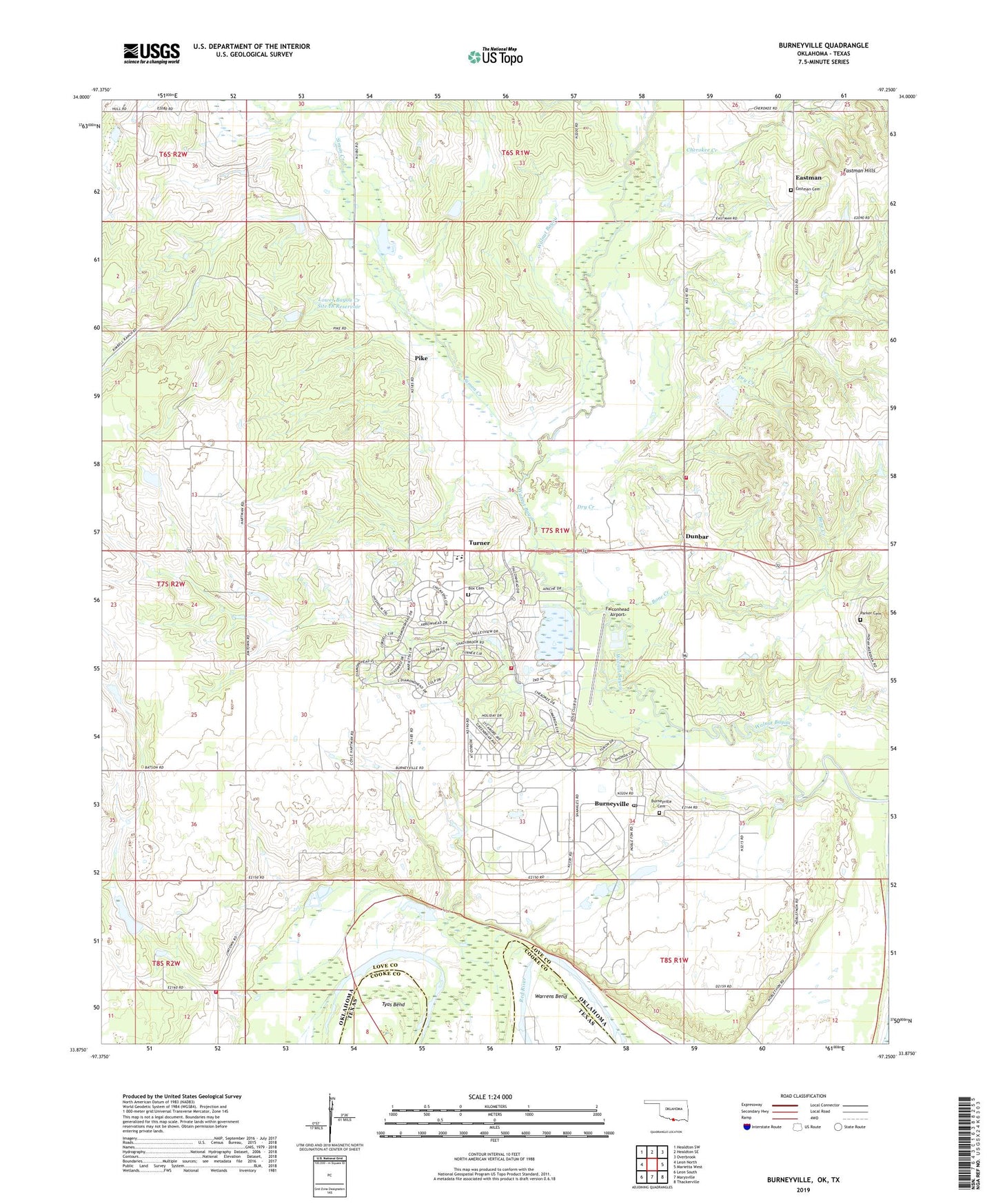
2019 topographic map quadrangle Burneyville in the state of Oklahoma. Scale: 1:24000. Based on the newly updated USGS 7.5' US Topo map series, this map is in the following counties: Love, Cooke. The map contains contour data, water features, and other items you are used to seeing on USGS maps, but also has updated roads and other features. This is the next generation of topographic maps. Printed on high-quality waterproof paper with UV fade-resistant inks.
Quads adjacent to this one:
West: Leon North
Northwest: Healdton SW
North: Healdton SE
Northeast: Overbrook
East: Marietta West
Southeast: Thackerville
South: Marysville
Southwest: Leon South
Contains the following named places: Bone Creek, Box Cemetery, Burneyville, Burneyville Cemetery, Burneyville Census Designated Place, Burneyville Post Office, Cherokee Creek, Dry Creek, Dunbar, Eastman, Eastman Cemetery, Eastman Community Volunteer Fire Department, Eastman Hills, Falconhead Airport, Falconhead Volunteer Fire Department, Jimtown Volunteer Fire Department, Lower Bayou Creek Site 17 Dam, Lower Bayou Creek Site 17 Reservoir, Lower Bayou Creek Site 18 Dam, Lower Bayou Creek Site 18 Reservoir, Oknoname 085006 Dam, Oknoname 085006 Reservoir, Parker Cemetery, Pike, Simon Creek, Township of Burney, Turner, Turner Elementary School, Turner High School, Turner Lodge, Tyas Bend, ZIP Code: 73430