MyTopo
Overbrook Oklahoma US Topo Map
Couldn't load pickup availability
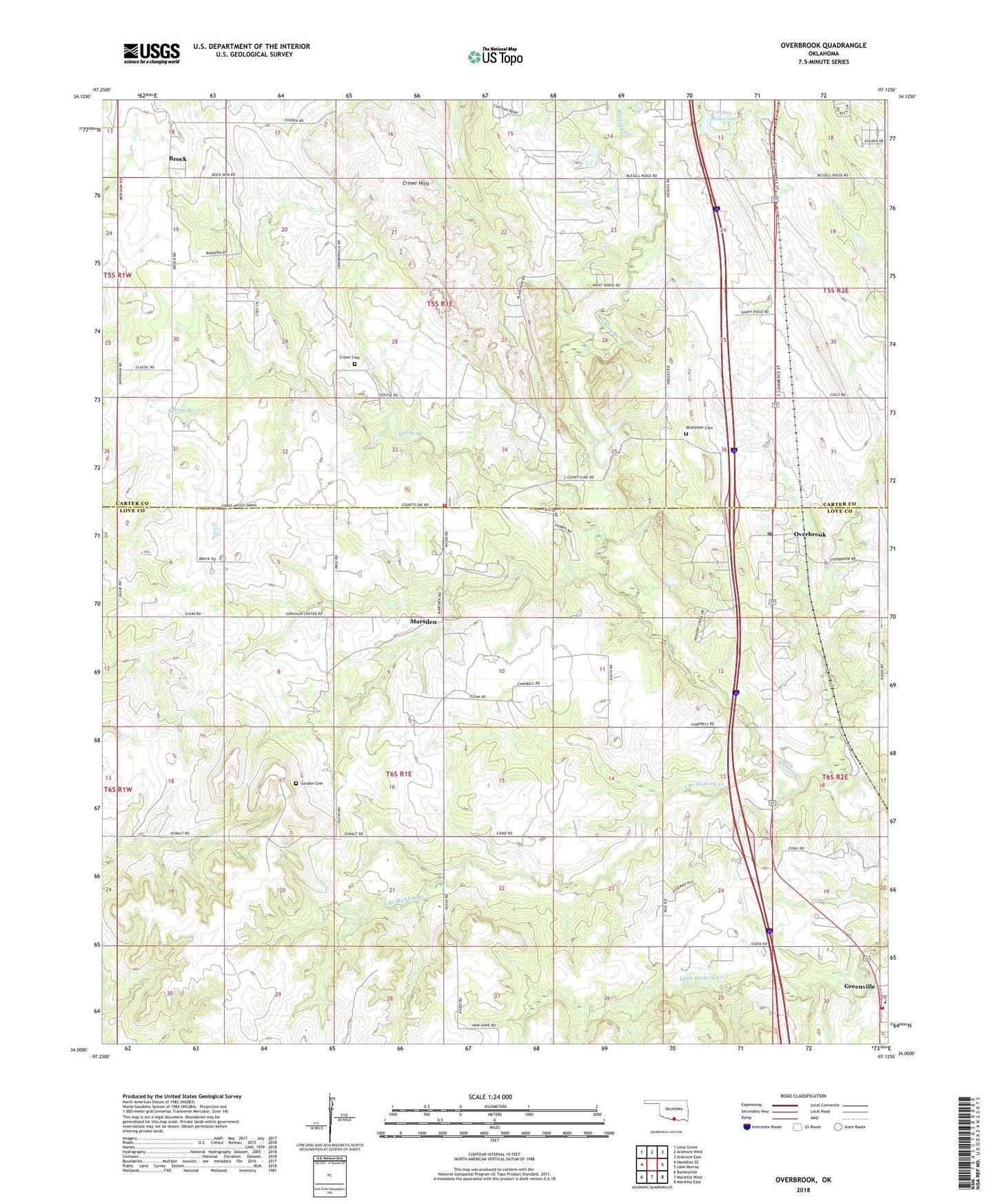
2022 topographic map quadrangle Overbrook in the state of Oklahoma. Scale: 1:24000. Based on the newly updated USGS 7.5' US Topo map series, this map is in the following counties: Love, Carter. The map contains contour data, water features, and other items you are used to seeing on USGS maps, but also has updated roads and other features. This is the next generation of topographic maps. Printed on high-quality waterproof paper with UV fade-resistant inks.
Quads adjacent to this one:
West: Healdton SE
Northwest: Lone Grove
North: Ardmore West
Northeast: Ardmore East
East: Lake Murray
Southeast: Marietta East
South: Marietta West
Southwest: Burneyville
This map covers the same area as the classic USGS quad with code o34097a2.
Contains the following named places: Brock, Brock Oil Field, Criner Cemetery, Criner Hills, Criner Hills Volunteer Fire Department, Crinerville Church, Gordon Cemetery, Greenville, Greenville - Overbrook Fire Department, Greenville Oil Field, Greenville School, KKAJ-FM (Ardmore), Marsden, McAlester Cemetery, McAlester Church, Oknoname 01903 Dam, Oknoname 01903 Reservoir, Oknoname 085004 Dam, Oknoname 085004 Reservoir, Overbrook, Overbrook Oil Field, Overbrook Post Office, Pleasant Hill Church, South Branch Hickory Creek, Spring Branch, Township of Hickory, ZIP Code: 73453