MyTopo
Butler Oklahoma US Topo Map
Couldn't load pickup availability
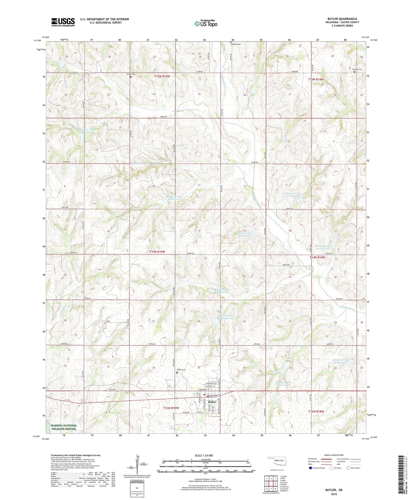
2022 topographic map quadrangle Butler in the state of Oklahoma. Scale: 1:24000. Based on the newly updated USGS 7.5' US Topo map series, this map is in the following counties: Custer. The map contains contour data, water features, and other items you are used to seeing on USGS maps, but also has updated roads and other features. This is the next generation of topographic maps. Printed on high-quality waterproof paper with UV fade-resistant inks.
Quads adjacent to this one:
West: McClure
Northwest: Leedey
North: Rhea
Northeast: Aledo
East: Anthon
Southeast: Stafford
South: Foss Dam
Southwest: Carpenter
This map covers the same area as the classic USGS quad with code o35099f2.
Contains the following named places: Adams Dam, Adams Reservoir, Antioch Cemetery, Antioch Church, Barnitz Creek Site 42 Dam, Barnitz Creek Site 42 Reservoir, Barnitz Creek Site 43 Dam, Barnitz Creek Site 43 Reservoir, Barnitz Creek Site 45 Dam, Barnitz Creek Site 45 Reservoir, Barnitz Creek Site 47 Dam, Barnitz Creek Site 47 Reservoir, Barnitz Creek Site 48 Reservoir, Barnitz Creek Site 49 Dam, Barnitz Creek Site 49 Reservoir, Barnitz Creek Site 50 Dam, Barnitz Creek Site 50 Reservoir, Barnitz Creek Site 51 Dam, Barnitz Creek Site 51 Reservoir, Barnitz Creek Site 53 Dam, Barnitz Creek Site 53 Reservoir, Barnitz Creek Site 54 Dam, Barnitz Creek Site 54 Reservoir, Barnitz Creek Site 55 Dam, Barnitz Creek Site 55 Reservoir, Barntiz Creek Site 48 Dam, Butler, Butler Cemetery, Butler Elementary School, Butler Emergency Medical Services, Butler Fire Department, Butler High School, Butler Police Department, Butler Post Office, Creach Dam, Creach Reservoir, Crooked Creek, Osceola Cemetery, Shiloh Cemetery, Town of Butler, Township of Barnitz, Twin Creek, V Fletcher Dam, V Fletcher Reservoir, ZIP Code: 73625