MyTopo
McClure Oklahoma US Topo Map
Couldn't load pickup availability
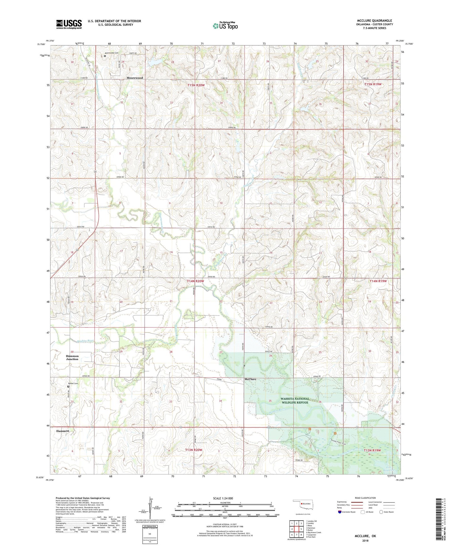
2022 topographic map quadrangle McClure in the state of Oklahoma. Scale: 1:24000. Based on the newly updated USGS 7.5' US Topo map series, this map is in the following counties: Custer. The map contains contour data, water features, and other items you are used to seeing on USGS maps, but also has updated roads and other features. This is the next generation of topographic maps. Printed on high-quality waterproof paper with UV fade-resistant inks.
Quads adjacent to this one:
West: Hammon
Northwest: Leedey SW
North: Leedey
Northeast: Rhea
East: Butler
Southeast: Foss Dam
South: Carpenter
Southwest: Big Kiowa Creek
This map covers the same area as the classic USGS quad with code o35099f3.
Contains the following named places: Bethel Cemetery, Butler Division, McClure, Moorewood, Moorewood Cemetery, North Branch Quartermaster Creek, Oknoname 039001 Dam, Oknoname 039001 Reservoir, Quartermaster Creek, Quartermaster Creek Site 28 Dam, Quartermaster Creek Site 28 Reservoir, Quartermaster Creek Site 29 Dam, Quartermaster Creek Site 29 Reservoir, Quartermaster Creek Site 30 Dam, Quartermaster Creek Site 30 Reservoir, Quartermaster Site 25 Dam, Quartermaster Site 25 Reservoir, Quartermaster Site 27 Dam, Quartermaster Site 27 Reservoir, White Shield Creek, Wild Horse Creek