MyTopo
Camargo Oklahoma US Topo Map
Couldn't load pickup availability
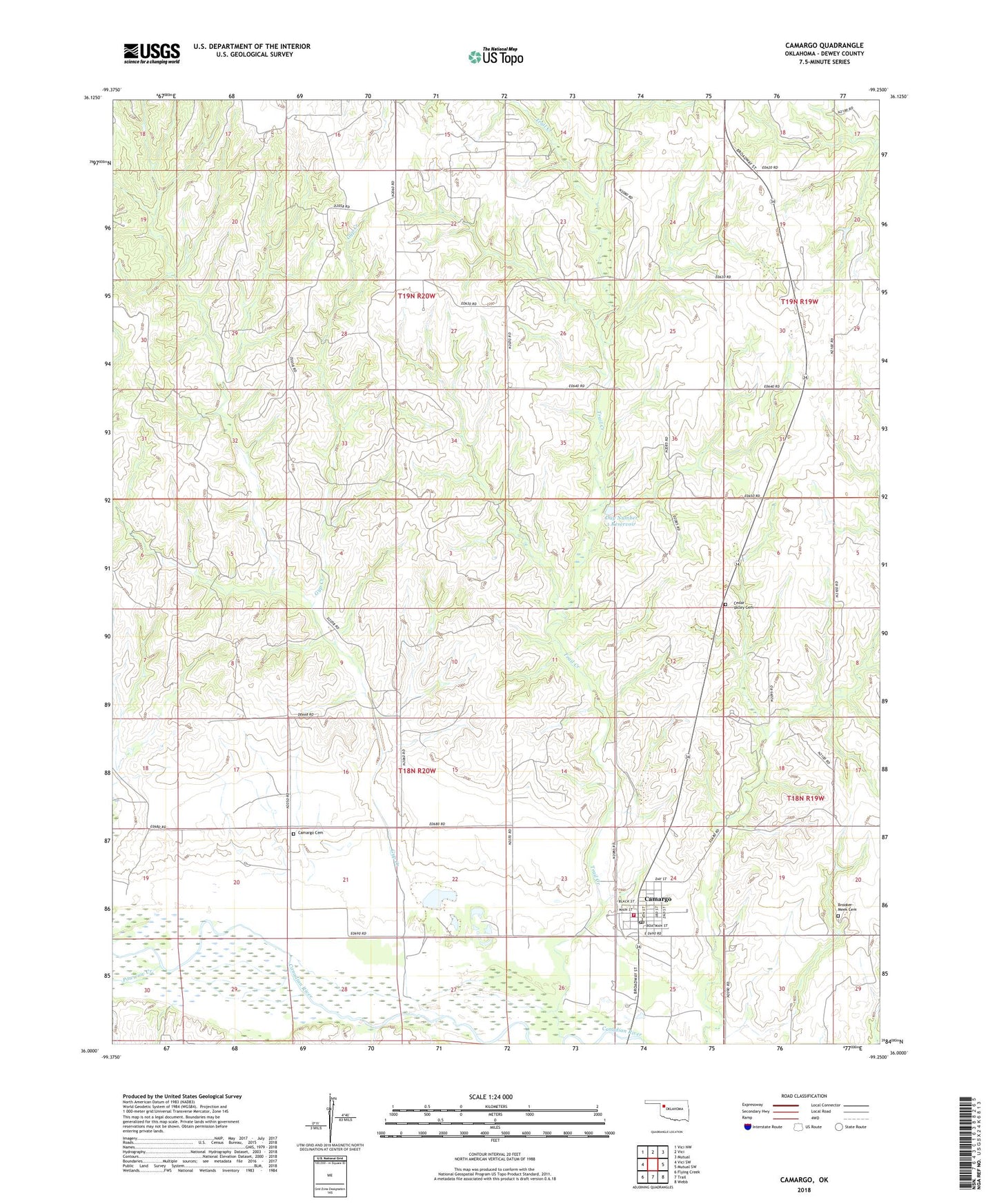
2022 topographic map quadrangle Camargo in the state of Oklahoma. Scale: 1:24000. Based on the newly updated USGS 7.5' US Topo map series, this map is in the following counties: Dewey. The map contains contour data, water features, and other items you are used to seeing on USGS maps, but also has updated roads and other features. This is the next generation of topographic maps. Printed on high-quality waterproof paper with UV fade-resistant inks.
Quads adjacent to this one:
West: Vici SW
Northwest: Vici NW
North: Vici
Northeast: Mutual
East: Mutual SW
Southeast: Webb
South: Trail
Southwest: Flying Creek
This map covers the same area as the classic USGS quad with code o36099a3.
Contains the following named places: Brooker-Meek Cemetery, Camargo, Camargo Cemetery, Camargo Post Office, Camargo Volunteer Fire Department, Cedar Valley Cemetery, Day Number 1 Dam, Day Number 1 Reservoir, Gyp Creek, Jeffrey Ecd 4 Dam, Jeffrey Ecd 4 Reservoir, Powwow Creek, Red Creek, Town of Camargo, Township of Cleveland, Township of Johnson, Trail Creek