MyTopo
Vici SW Oklahoma US Topo Map
Couldn't load pickup availability
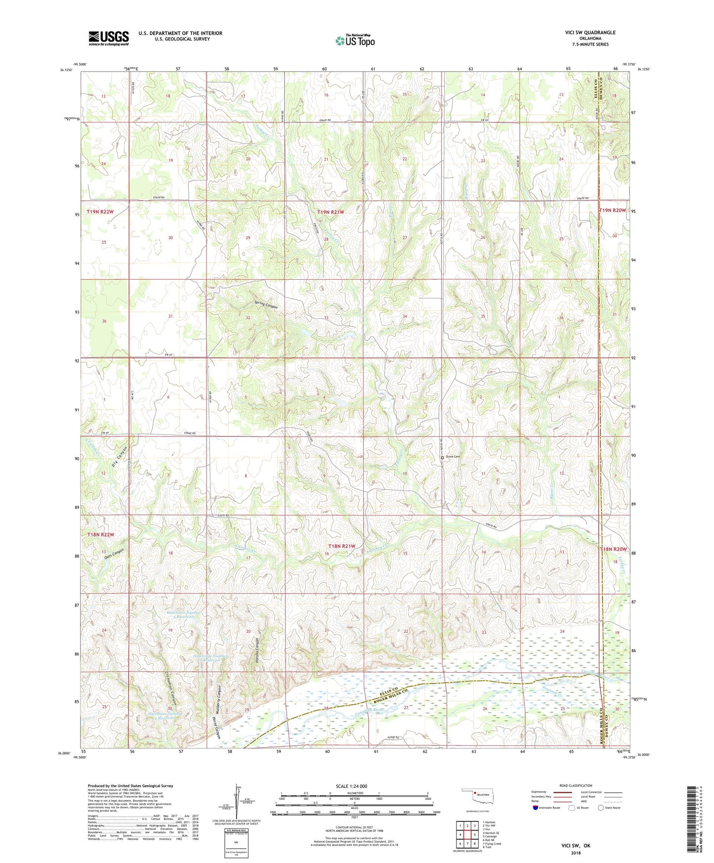
2022 topographic map quadrangle Vici SW in the state of Oklahoma. Scale: 1:24000. Based on the newly updated USGS 7.5' US Topo map series, this map is in the following counties: Ellis, Dewey, Roger Mills. The map contains contour data, water features, and other items you are used to seeing on USGS maps, but also has updated roads and other features. This is the next generation of topographic maps. Printed on high-quality waterproof paper with UV fade-resistant inks.
Quads adjacent to this one:
West: Harmon SE
Northwest: Harmon
North: Vici NW
Northeast: Vici
East: Camargo
Southeast: Trail
South: Flying Creek
Southwest: Roll NE
This map covers the same area as the classic USGS quad with code o36099a4.
Contains the following named places: Cinnamon Canyon, Dry Canyon, Harsha Canyon, Horse Canyon, Hutchison Number 1 Dam, Hutchison Number 1 Reservoir, Hutchison Number 2 Dam, Hutchison Number 2 Reservoir, Hutchison Number 5 Dam, Hutchison Number 5 Reservoir, Kyser Creek, Mulberry Canyon, Oats Canyon, Piles Creek, South Turkey Creek, Spring Canyon, Stone Cemetery, Township of Parkman, Turkey Creek