MyTopo
Carson Oklahoma US Topo Map
Couldn't load pickup availability
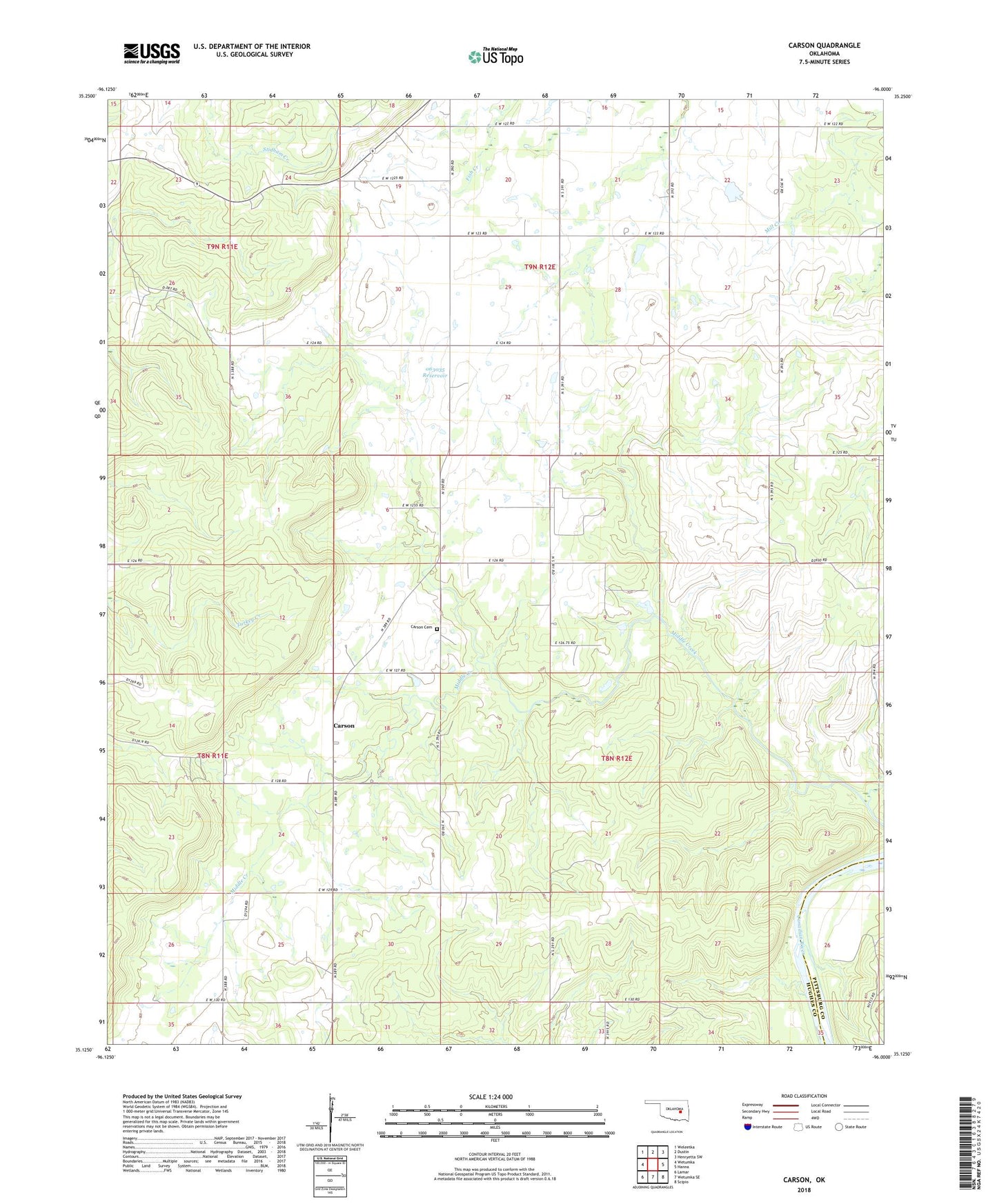
2018 topographic map quadrangle Carson in the state of Oklahoma. Scale: 1:24000. Based on the newly updated USGS 7.5' US Topo map series, this map is in the following counties: Hughes, Pittsburg. The map contains contour data, water features, and other items you are used to seeing on USGS maps, but also has updated roads and other features. This is the next generation of topographic maps. Printed on high-quality waterproof paper with UV fade-resistant inks.
Quads adjacent to this one:
West: Wetumka
Northwest: Weleetka
North: Dustin
Northeast: Henryetta SW
East: Hanna
Southeast: Scipio
South: Wetumka SE
Southwest: Lamar
Contains the following named places: Ben Huffman Dam, Ben Huffman Reservoir, Carson, Carson Cemetery, Oknoname 063011 Dam, Oknoname 063011 Reservoir, Oknoname 063035 Dam, Oknoname 063035 Reservoir, Township of Dustin, ZIP Code: 74839