MyTopo
Weleetka Oklahoma US Topo Map
Couldn't load pickup availability
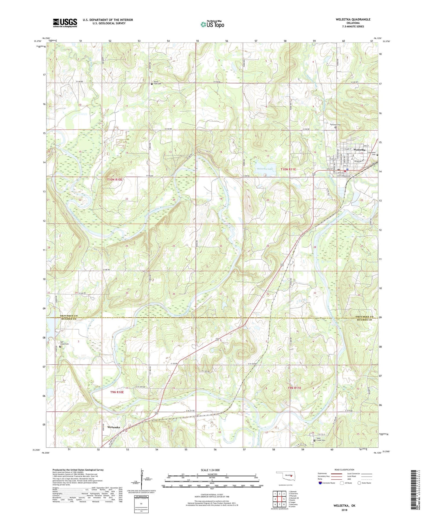
2022 topographic map quadrangle Weleetka in the state of Oklahoma. Scale: 1:24000. Based on the newly updated USGS 7.5' US Topo map series, this map is in the following counties: Okfuskee, Hughes. The map contains contour data, water features, and other items you are used to seeing on USGS maps, but also has updated roads and other features. This is the next generation of topographic maps. Printed on high-quality waterproof paper with UV fade-resistant inks.
Quads adjacent to this one:
West: Okemah SE
Northwest: Okemah
North: Clearview
Northeast: Pharoah
East: Dustin
Southeast: Carson
South: Wetumka
Southwest: Yeager
This map covers the same area as the classic USGS quad with code o35096c2.
Contains the following named places: Alabama Church, East Wetumka Oil and Gas Field, Fairlawn Cemetery, First Christian Church, Flat Rock Creek, Graham Elementary School, Graham High School, Hillcrest Cemetery, Lake Wetumka Dam, North Fork Cemetery, North Fork Church, Salt Creek Cemetery, Salt Creek Church, Sand Creek Cemetery, Sand Creek Church, South Alabama Oil and Gas Field, Southwest Alabama Oil Field, Spence Memorial Elementary School, Town of Weleetka, Township of Hickory Ridge, Weleetka, Weleetka Dam, Weleetka Division, Weleetka Graham Emergency Medical Services, Weleetka High School, Weleetka Junior High School, Weleetka Lake, Weleetka Oil Field, Weleetka Police Department, Weleetka Post Office, Weleetka Volunteer Fire Department, West Alabama Oil Field, West Weleetka Oil Field, Wewoka Creek