MyTopo
Wetumka Oklahoma US Topo Map
Couldn't load pickup availability
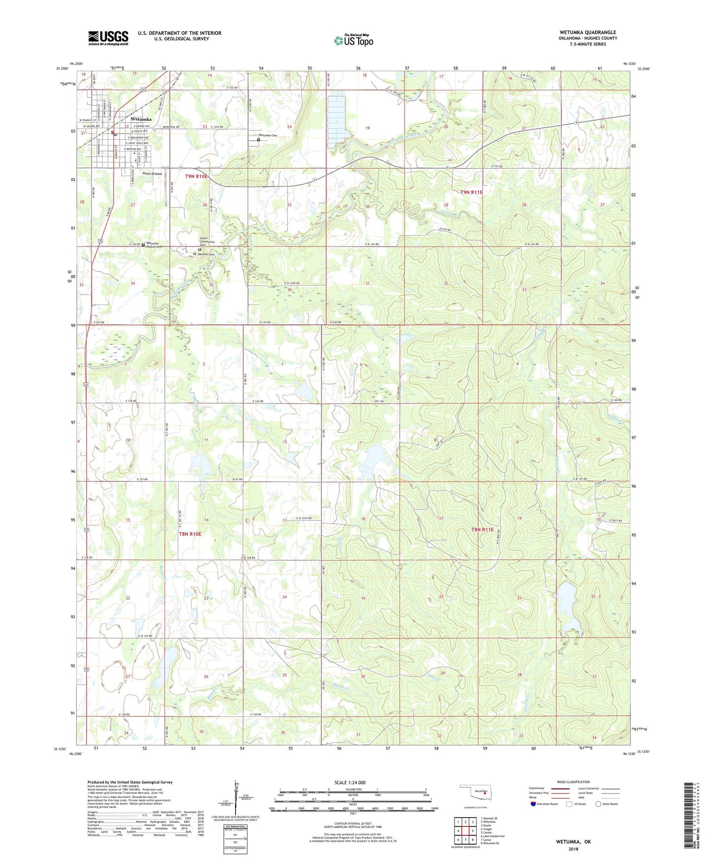
2022 topographic map quadrangle Wetumka in the state of Oklahoma. Scale: 1:24000. Based on the newly updated USGS 7.5' US Topo map series, this map is in the following counties: Hughes. The map contains contour data, water features, and other items you are used to seeing on USGS maps, but also has updated roads and other features. This is the next generation of topographic maps. Printed on high-quality waterproof paper with UV fade-resistant inks.
Quads adjacent to this one:
West: Yeager
Northwest: Okemah SE
North: Weleetka
Northeast: Dustin
East: Carson
Southeast: Wetumka SE
South: Lamar
Southwest: Lake Holdenville
This map covers the same area as the classic USGS quad with code o35096b2.
Contains the following named places: Barnett Cemetery, Big Springs Church, Brooks Lake, Christian Church, Church of Christ, City of Wetumka, Don Wallace Dam, Don Wallace Reservoir, Fish Creek, George Smith Dam, George Smith Reservoir, Greasy Creek, John Heath Dam, John Heath Reservoir, Little Wewoka Creek Site 15 Dam, Little Wewoka Creek Site 15 Reservoir, Little Wewoka Creek Site 16 Dam, Little Wewoka Creek Site 16 Reservoir, Little Wewoka Creek Site 17 Dam, Little Wewoka Creek Site 17 Reservoir, Little Wewoka Creek Site 18 Dam, Little Wewoka Creek Site 18 Reservoir, Lone Star Church, Oknoname 063008 Dam, Oknoname 063008 Reservoir, Oknoname 063040 Dam, Oknoname 063040 Reservoir, Petes Airpark, Pleasant Ridge Church, Ranch Creek, South Community Cemetery, Thewarley Church, Township of Wetumka, Turkey Creek, Wetumka, Wetumka Cemetery, Wetumka Church, Wetumka Division, Wetumka Elementary School, Wetumka Fire Department, Wetumka High School, Wetumka Hospital Heliport, Wetumka Indian Baptist Church Cemetery, Wetumka Police Department, Wetumka Post Office, ZIP Code: 74883