MyTopo
Cheyenne NW Oklahoma US Topo Map
Couldn't load pickup availability
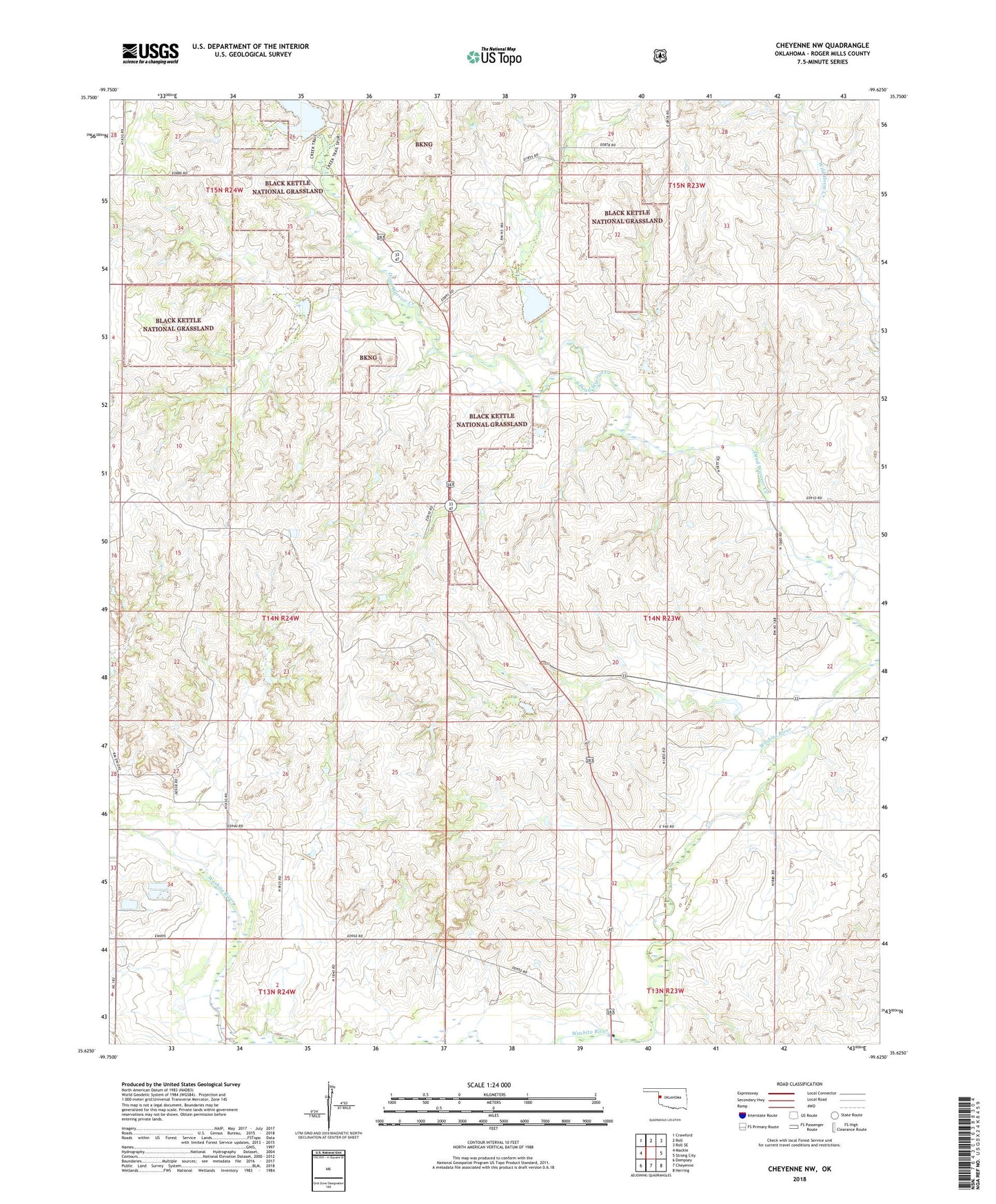
2018 topographic map quadrangle Cheyenne NW in the state of Oklahoma. Scale: 1:24000. Based on the newly updated USGS 7.5' US Topo map series, this map is in the following counties: Roger Mills. The map contains contour data, water features, and other items you are used to seeing on USGS maps, but also has updated roads and other features. This is the next generation of topographic maps. Printed on high-quality waterproof paper with UV fade-resistant inks.
Quads adjacent to this one:
West: Mackie
Northwest: Crawford
North: Roll
Northeast: Roll SE
East: Strong City
Southeast: Herring
South: Cheyenne
Southwest: Dempsey
Contains the following named places: Barnitz Creek Site 44 Dam, Barnitz Creek Site 44 Reservoir, Barnitz Creek Site 46 Dam, Barnitz Creek Site 46 Reservoir, Beaver Dam Creek Site 6 Dam, Beaver Dam Creek Site 6 Reservoir, Black Kettle Recreation Area, Cheyenne West Gas Field, Dead Indian-Wildhorse Site 10 Dam, Dead Indian-Wildhorse Site 10 Reservoir, Dead Indian-Wildhorse Site 11 Dam, Dead Indian-Wildhorse Site 11 Reservoir, Dead Indian-Wildhorse Site 3 Dam, Dead Indian-Wildhorse Site 3 Reservoir, Dead Indian-Wildhorse Site 4 Dam, Dead Indian-Wildhorse Site 4 Reservoir, Dead Indian-Wildhorse Site 5 Dam, Dead Indian-Wildhorse Site 5 Reservoir, Dead Indian-Wildhorse Site 6 Dam, Dead Indian-Wildhorse Site 6 Reservoir, Dead Indian-Wildhorse Site 7 Dam, Dead Indian-Wildhorse Site 7 Reservoir, Dead Indian-Wildhorse Site 8 Reservoir, Dead Indian-Wildhorse Site 9 Dam, Dead Indian-Wildhorse Site 9 Reservoir, Dead Warrior Lake, Dean Indian-Wildhorse Site 8 Dam, R Wickham Number 5 Dam, R Wickham Number 5 Reservoir, Roger Mills County, Roll SW Gas Field, Sergeant Major Creek, Strong City District Gas Field, Township of Cheyenne, ZIP Code: 73628