MyTopo
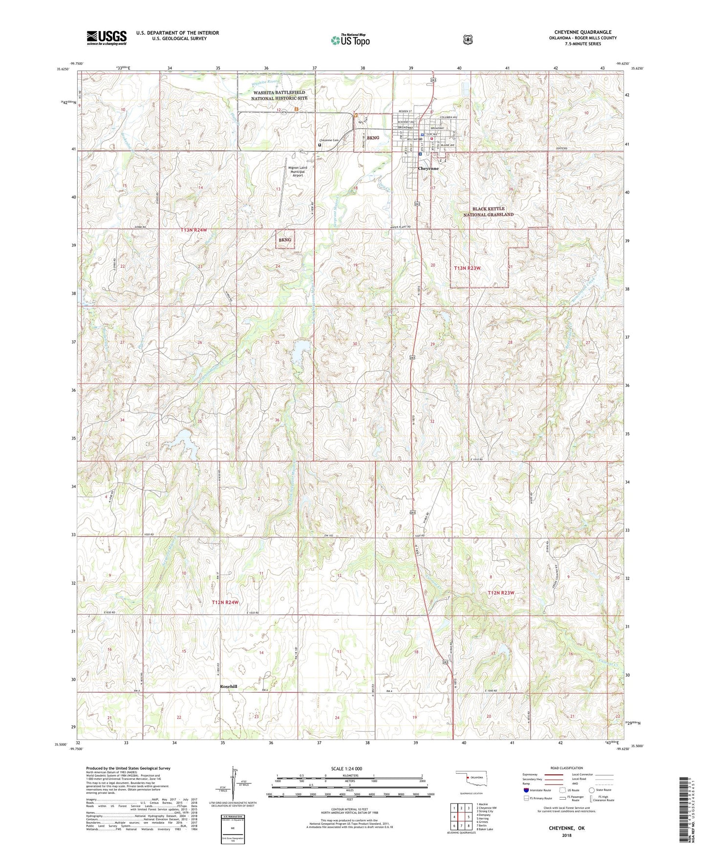
Cheyenne Oklahoma US Topo Map
Couldn't load pickup availability
Also explore the Cheyenne Forest Service Topo of this same quad for updated USFS data
2022 topographic map quadrangle Cheyenne in the state of Oklahoma. Scale: 1:24000. Based on the newly updated USGS 7.5' US Topo map series, this map is in the following counties: Roger Mills. The map contains contour data, water features, and other items you are used to seeing on USGS maps, but also has updated roads and other features. This is the next generation of topographic maps. Printed on high-quality waterproof paper with UV fade-resistant inks.
Quads adjacent to this one:
West: Dempsey
Northwest: Mackie
North: Cheyenne NW
Northeast: Strong City
East: Herring
Southeast: Baker Lake
South: Berlin
Southwest: Grimes
This map covers the same area as the classic USGS quad with code o35099e6.
Contains the following named places: Baptist Church, Battle of the Washita Historical Marker, Beaty Dam, Beaty Reservoir, Beaver Dam Creek Site 3, Black Kettle Forest Service Facility, Black Kettle Ranger District Office, Broken Leg Creek Site 1 Dam, Broken Leg Creek Site 1 Reservoir, Brokenleg Creek, Cheyenne, Cheyenne Cemetery, Cheyenne Elementary School, Cheyenne Fire Department, Cheyenne High School, Cheyenne Post Office, Dry Creek, East Fork Sergeant Major Creek, KWET-TV (Cheyenne), L J Pankey Heliport, Memorial Park, Mignon Laird Municipal Airport, Plum Creek, Roger Mills County Ambulance Service Cheyenne, Roger Mills County Jail, Roger Mills County Sheriff's Office, Roger Mills Memorial Hospital, Rosehill, Sandstone Creek Site 113 Dam, Sandstone Creek Site 113 Reservoir, Sandstone Creek Site 114 Dam, Sandstone Creek Site 114 Reservoir, Sandstone Creek Site 115 Dam, Sandstone Creek Site 115 Reservoir, Sargeant Major Creek Site 1 Dam, Sargeant Major Creek Site 1 Reservoir, Sargeant Major Creek Site 2 Dam, Sargeant Major Creek Site 2 Reservoir, Sargeant Major Creek Site 3 Dam, Sargeant Major Creek Site 3 Reservoir, Sargeant Major Creek Site 4 Dam, Sargeant Major Creek Site 4 Reservoir, Sargeant Major Creek Site 5 Dam, Sargeant Major Creek Site 5 Reservoir, Sargeant Major Creek Site 6 Dam, Sargeant Major Creek Site 6 Reservoir, Sprowles Number 1 Dam, Sprowles Number 1 Reservoir, Sprowles Number 3 Dam, Sprowles Number 3 Reservoir, Town of Cheyenne, Washita Battlefield National Historic Site