MyTopo
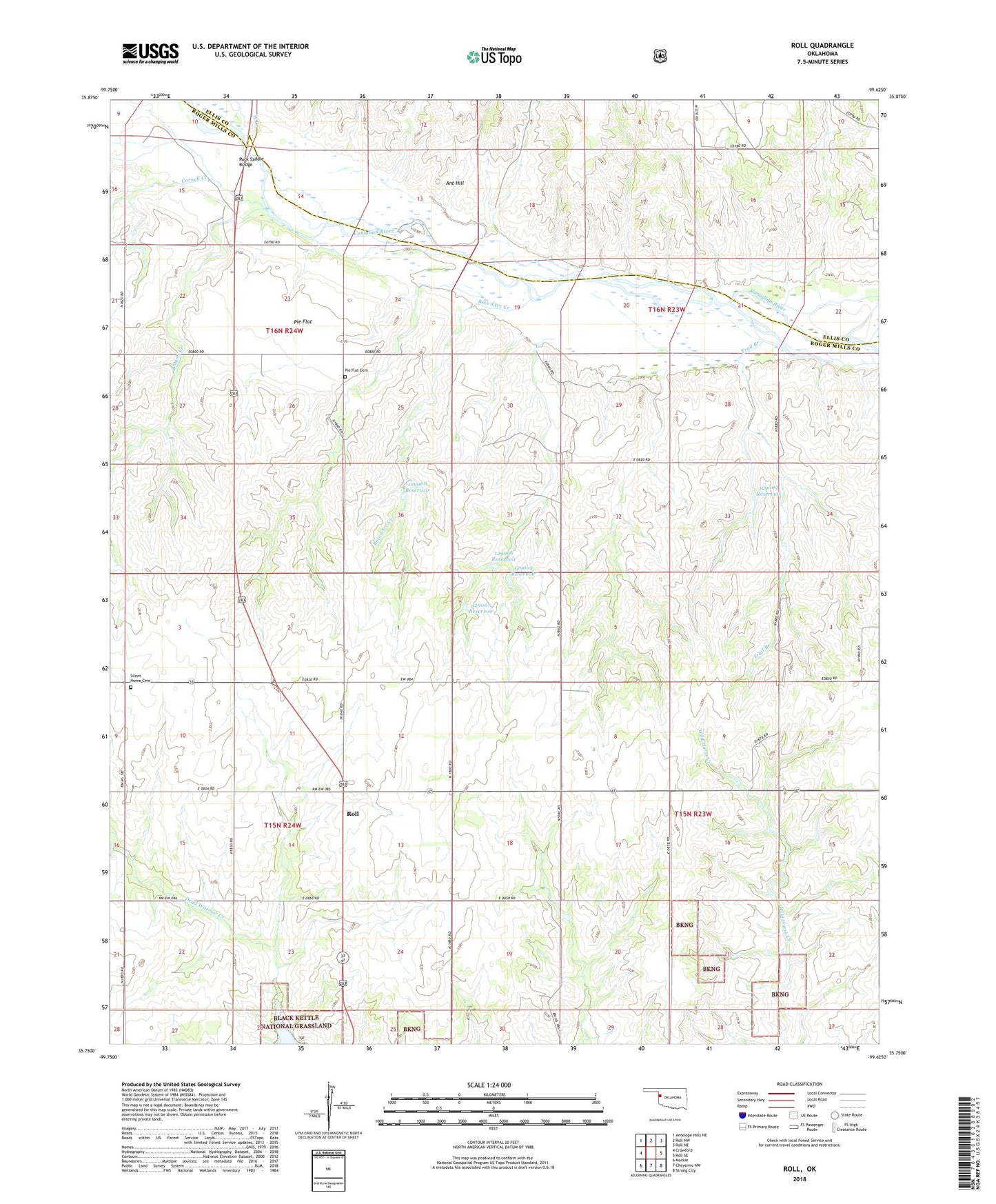
Roll Oklahoma US Topo Map
Couldn't load pickup availability
Also explore the Roll Forest Service Topo of this same quad for updated USFS data
2022 topographic map quadrangle Roll in the state of Oklahoma. Scale: 1:24000. Based on the newly updated USGS 7.5' US Topo map series, this map is in the following counties: Roger Mills, Ellis. The map contains contour data, water features, and other items you are used to seeing on USGS maps, but also has updated roads and other features. This is the next generation of topographic maps. Printed on high-quality waterproof paper with UV fade-resistant inks.
Quads adjacent to this one:
West: Crawford
Northwest: Antelope Hills NE
North: Roll NW
Northeast: Roll NE
East: Roll SE
Southeast: Strong City
South: Cheyenne NW
Southwest: Mackie
This map covers the same area as the classic USGS quad with code o35099g6.
Contains the following named places: Ant Hill, Bois dArc Creek, Cornell Creek, Oknoname 129001 Dam, Oknoname 129001 Reservoir, Oknoname 129002 Dam, Oknoname 129002 Reservoir, Oknoname 129004 Dam, Oknoname 129004 Reservoir, Oknoname 129005 Dam, Oknoname 129005 Reservoir, Oknoname 129006 Dam, Oknoname 129006 Reservoir, Oknoname 129007 Dam, Oknoname 129007 Reservoir, Oknoname 129008 Dam, Oknoname 129008 Reservoir, Pack Saddle Bridge, Pie Flat, Pie Flat Cemetery, R Wickham Number 1 Dam, R Wickham Number 1 Reservoir, Roll, Silent Home Cemetery, Township of Streeter, Trail Branch, Tri-County Turkey Creek Site 2 Dam, Tri-County Turkey Creek Site 2 Reservoir, Wagon Creek, West Creek