MyTopo
Cleo Springs Oklahoma US Topo Map
Couldn't load pickup availability
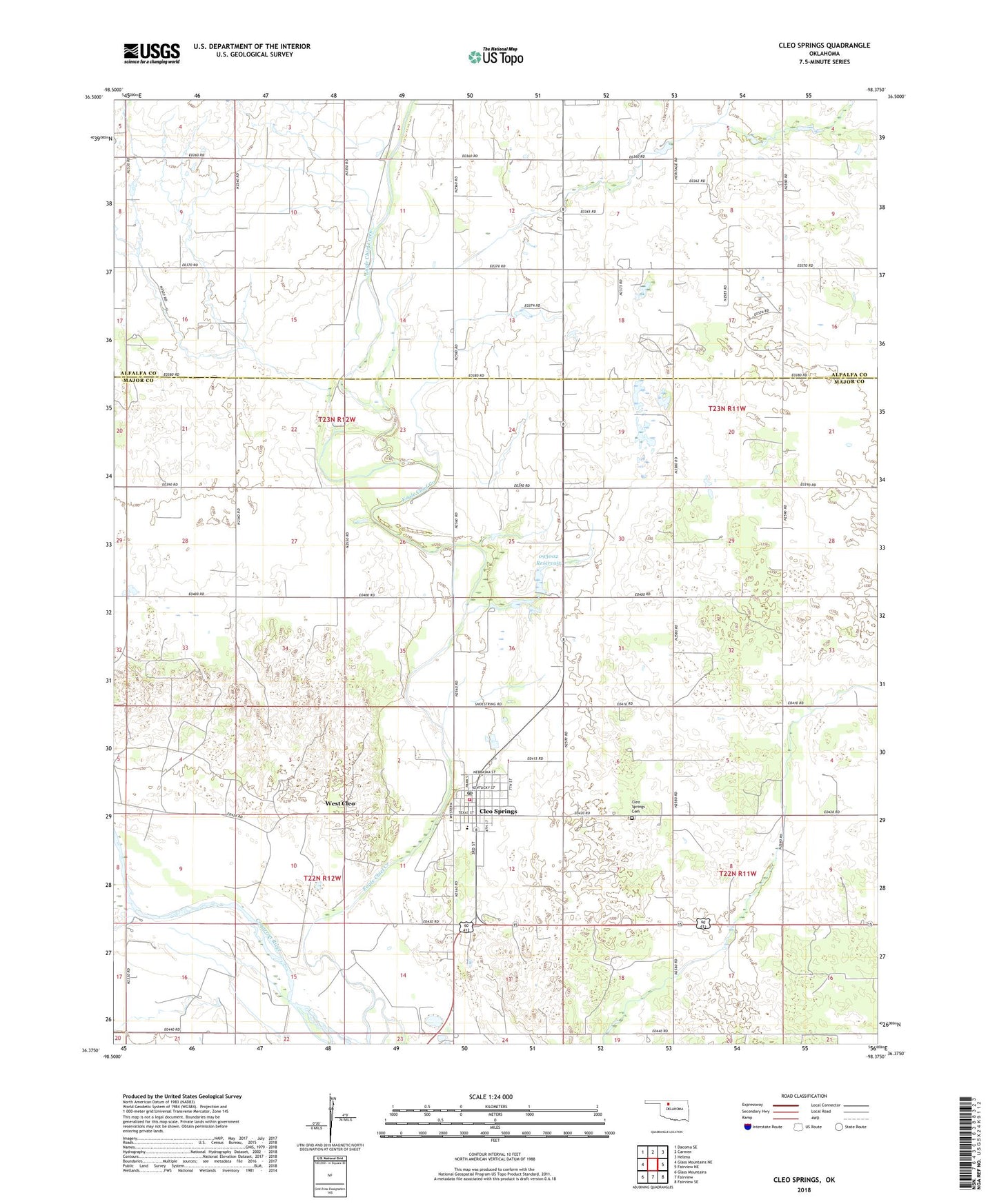
2022 topographic map quadrangle Cleo Springs in the state of Oklahoma. Scale: 1:24000. Based on the newly updated USGS 7.5' US Topo map series, this map is in the following counties: Major, Alfalfa. The map contains contour data, water features, and other items you are used to seeing on USGS maps, but also has updated roads and other features. This is the next generation of topographic maps. Printed on high-quality waterproof paper with UV fade-resistant inks.
Quads adjacent to this one:
West: Glass Mountains NE
Northwest: Dacoma SE
North: Carmen
Northeast: Helena
East: Fairview NE
Southeast: Fairview SE
South: Fairview
Southwest: Glass Mountains
This map covers the same area as the classic USGS quad with code o36098d4.
Contains the following named places: Aline - Cleo Elementary School, Cleo Springs, Cleo Springs Cemetery, Cleo Springs Post Office, Cleo Springs Volunteer Fire Department, Eagle Chief Airport, Oknoname 093002 Dam, Oknoname 093002 Reservoir, Town of Cleo Springs, Township of Aline, Township of Cleo, West Cleo, ZIP Code: 73729