MyTopo
Fairview Oklahoma US Topo Map
Couldn't load pickup availability
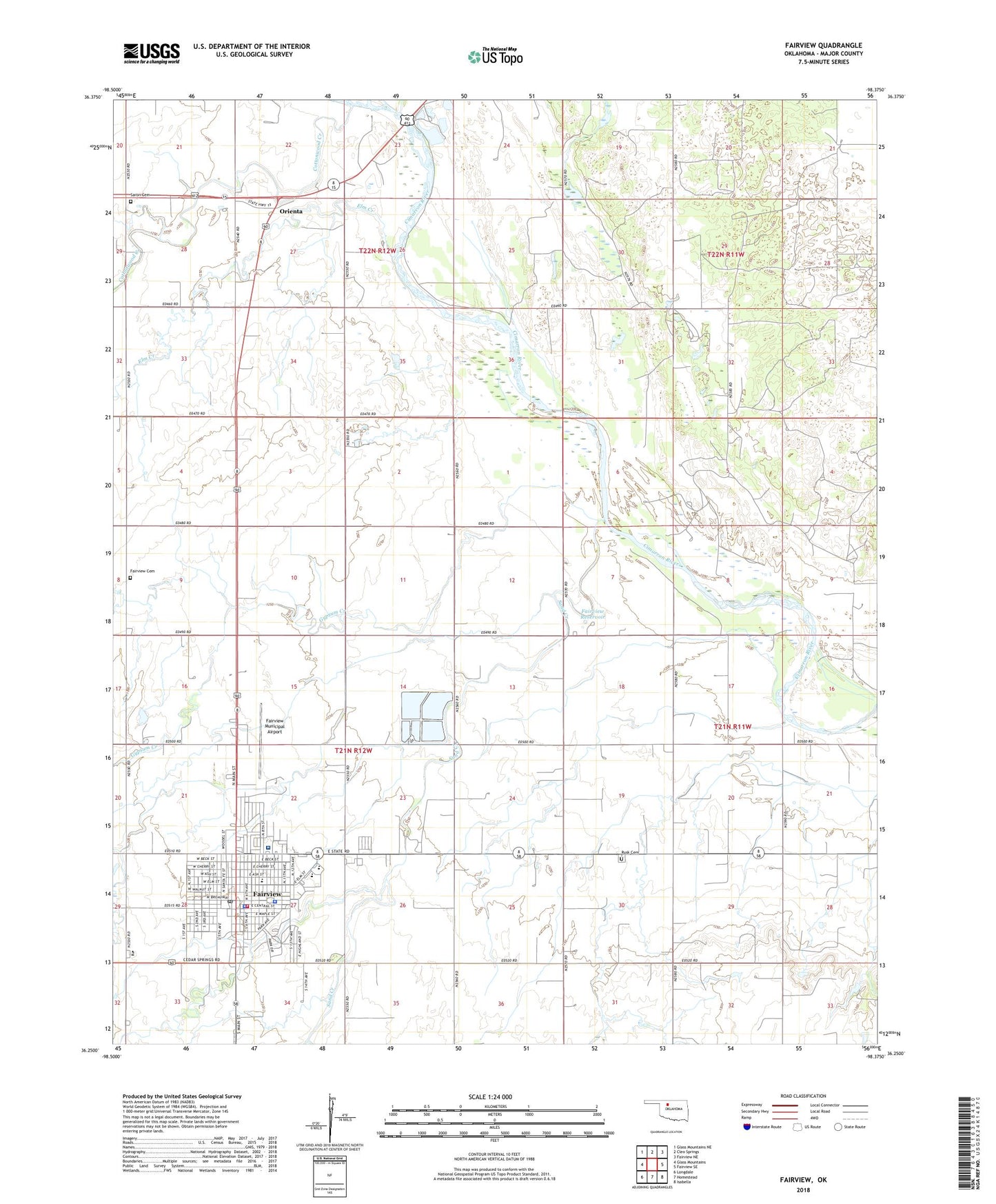
2022 topographic map quadrangle Fairview in the state of Oklahoma. Scale: 1:24000. Based on the newly updated USGS 7.5' US Topo map series, this map is in the following counties: Major. The map contains contour data, water features, and other items you are used to seeing on USGS maps, but also has updated roads and other features. This is the next generation of topographic maps. Printed on high-quality waterproof paper with UV fade-resistant inks.
Quads adjacent to this one:
West: Glass Mountains
Northwest: Glass Mountains NE
North: Cleo Springs
Northeast: Fairview NE
East: Fairview SE
Southeast: Isabella
South: Homestead
Southwest: Longdale
This map covers the same area as the classic USGS quad with code o36098c4.
Contains the following named places: Camp Saline, Central Christian Church, Chamberlain Middle School, Church of Christ, Church of the Nazarene, City of Fairview, Cornelsen Elementary School, Cottonwood Creek, Eagle Chief Creek, Elm Creek, Fairview, Fairview Cemetery, Fairview City Wells, Fairview Fire Department, Fairview High School, Fairview Municipal Airport, Fairview Police Department, Fairview Post Office, Fairview Regional Medical Center, Fairview Reservoir, First Baptist Church, First United Methodist Church, Gypsum Creek, Major County Emergency Medical Services, Major County Jail, Major County Sheriff's Office, Northwest Technology Center Fairview, Orienta, Rusk Cemetery, Sand Creek, Saron Cemetery, Saron Church