MyTopo
Cleveland Oklahoma US Topo Map
Couldn't load pickup availability
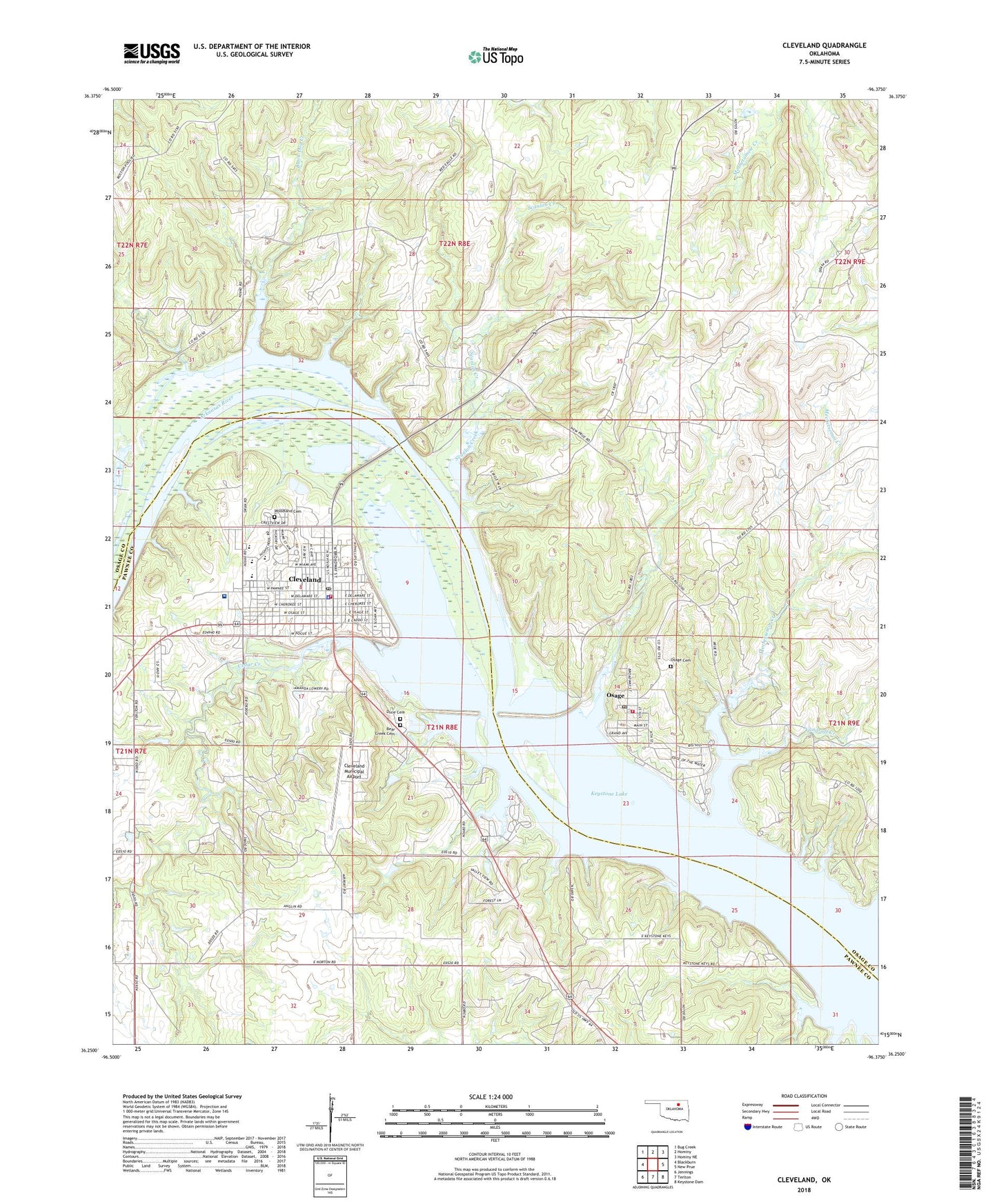
2018 topographic map quadrangle Cleveland in the state of Oklahoma. Scale: 1:24000. Based on the newly updated USGS 7.5' US Topo map series, this map is in the following counties: Osage, Pawnee. The map contains contour data, water features, and other items you are used to seeing on USGS maps, but also has updated roads and other features. This is the next generation of topographic maps. Printed on high-quality waterproof paper with UV fade-resistant inks.
Quads adjacent to this one:
West: Blackburn
Northwest: Bug Creek
North: Hominy
Northeast: Hominy NE
East: New Prue
Southeast: Keystone Dam
South: Terlton
Southwest: Jennings
Contains the following named places: Bear Creek Cemetery, Black Dog Creek, Boar Creek Oil Field, Boston Oil Field, Cedar Creek, City of Cleveland, Cleveland, Cleveland Area Hospital, Cleveland Fire Department, Cleveland High School, Cleveland Intermediate Elementary School, Cleveland Middle School, Cleveland Municipal Airport, Cleveland Oil Field, Cleveland Police Department, Cleveland Post Office, Cleveland Primary Elementary School, Dixie Cemetery, Feyodi Creek State Park, First Assembly of God, First Baptist Church, First Christian Church, First Presbyterian Church, Grace Baptist Church, Kingdom Hall-Jehovahs Witness, Lauderdale Oil Field, Mechetsemoi Creek, Mercy Regional Ambulance Service Cleveland, Methodist Church, Mill Creek, Oknoname 113100 Dam, Oknoname 113100 Reservoir, Oknoname 113101 Dam, Oknoname 113101 Reservoir, Osage, Osage Cemetery, Osage City Oil Field, Osage Point Park, Osage Post Office, Osage Volunteer Fire Department, Sand Creek, Scanlon Creek, Town of Osage, Township of Jordan Valley, Vandruff Creek, Woodland Cemetery