MyTopo
Terlton Oklahoma US Topo Map
Couldn't load pickup availability
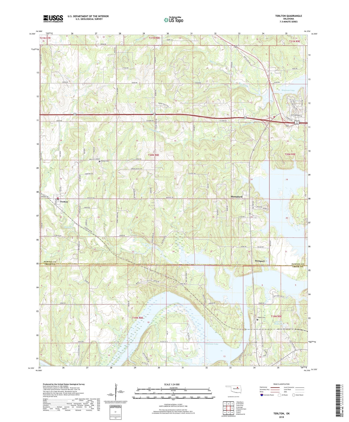
2022 topographic map quadrangle Terlton in the state of Oklahoma. Scale: 1:24000. Based on the newly updated USGS 7.5' US Topo map series, this map is in the following counties: Pawnee, Creek. The map contains contour data, water features, and other items you are used to seeing on USGS maps, but also has updated roads and other features. This is the next generation of topographic maps. Printed on high-quality waterproof paper with UV fade-resistant inks.
Quads adjacent to this one:
West: Jennings
Northwest: Blackburn
North: Cleveland
Northeast: New Prue
East: Keystone Dam
Southeast: Mannford SE
South: Olive
Southwest: Oilton
This map covers the same area as the classic USGS quad with code o36096b4.
Contains the following named places: Cleveland Division, Cowskin Creek, House Creek, Keystone Camp, Mannford Ramp Recreation Area, Mannford Water Supply Lake, North 48 Volunteer Fire Department, Oakhill Cemetery, Oknoname 037005 Dam, Oknoname 037005 Reservoir, Oknoname 037006 Dam, Oknoname 037006 Reservoir, Rawnee Cove Recreation Area, Terlton, Terlton Cemetery, Terlton Fire Department, Terlton Post Office, Town of Terlton, Township of House Creek, ZIP Codes: 74020, 74081