MyTopo
New Prue Oklahoma US Topo Map
Couldn't load pickup availability
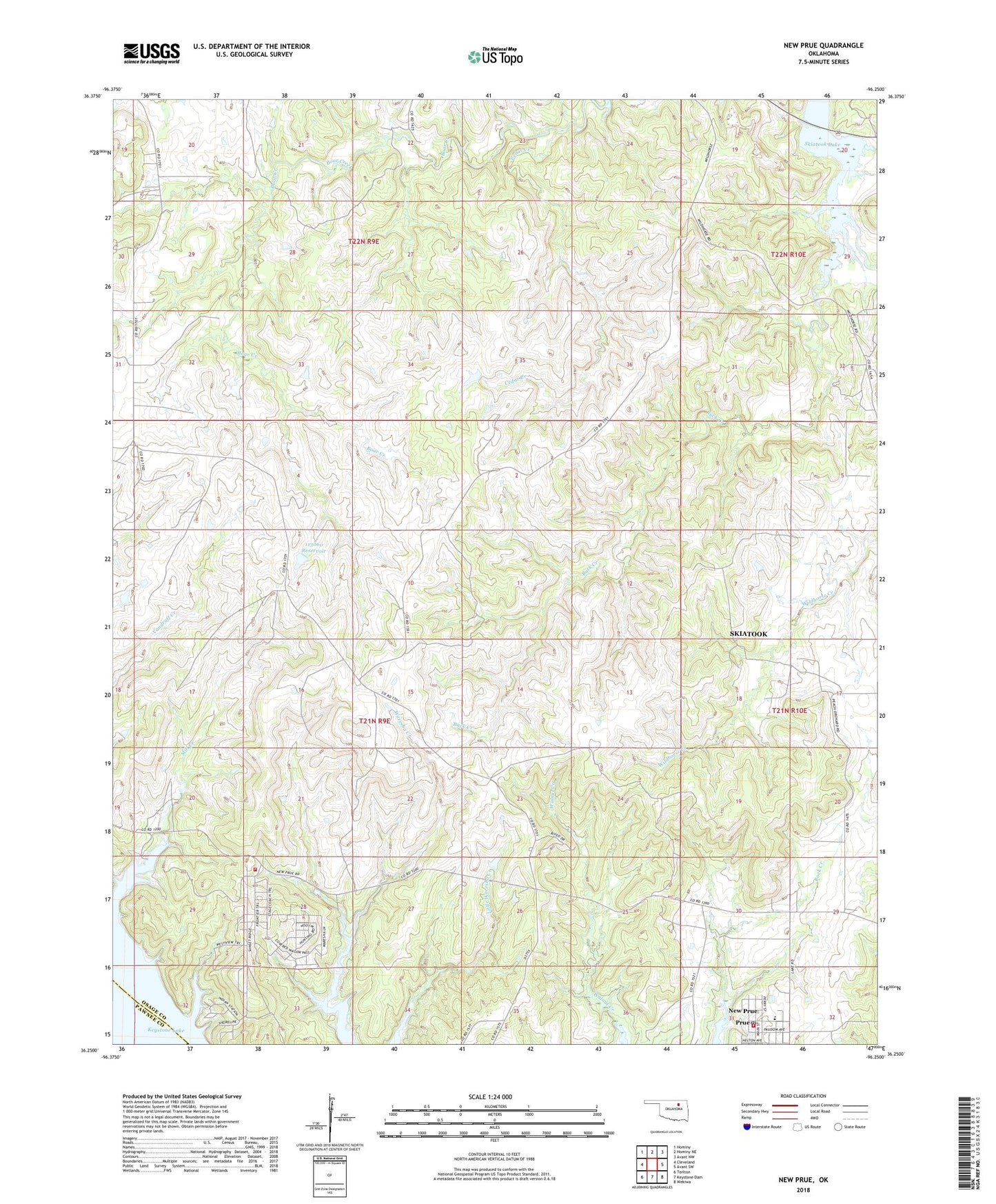
2022 topographic map quadrangle New Prue in the state of Oklahoma. Scale: 1:24000. Based on the newly updated USGS 7.5' US Topo map series, this map is in the following counties: Osage, Pawnee. The map contains contour data, water features, and other items you are used to seeing on USGS maps, but also has updated roads and other features. This is the next generation of topographic maps. Printed on high-quality waterproof paper with UV fade-resistant inks.
Quads adjacent to this one:
West: Cleveland
Northwest: Hominy
North: Hominy NE
Northeast: Avant NW
East: Avant SW
Southeast: Wekiwa
South: Keystone Dam
Southwest: Terlton
This map covers the same area as the classic USGS quad with code o36096c3.
Contains the following named places: Buck Creek, Cedar Creek, East Osage City Oil Field, Frontier Fire District, New Prue, Oknoname 113060 Dam, Oknoname 113060 Reservoir, Prue Elementary School, Prue High School, Prue Post Office, Prue Volunteer Fire Department, Twin Creek Oil Field, Walnut Creek Peninsula Park, ZIP Code: 74054