MyTopo
Blackburn Oklahoma US Topo Map
Couldn't load pickup availability
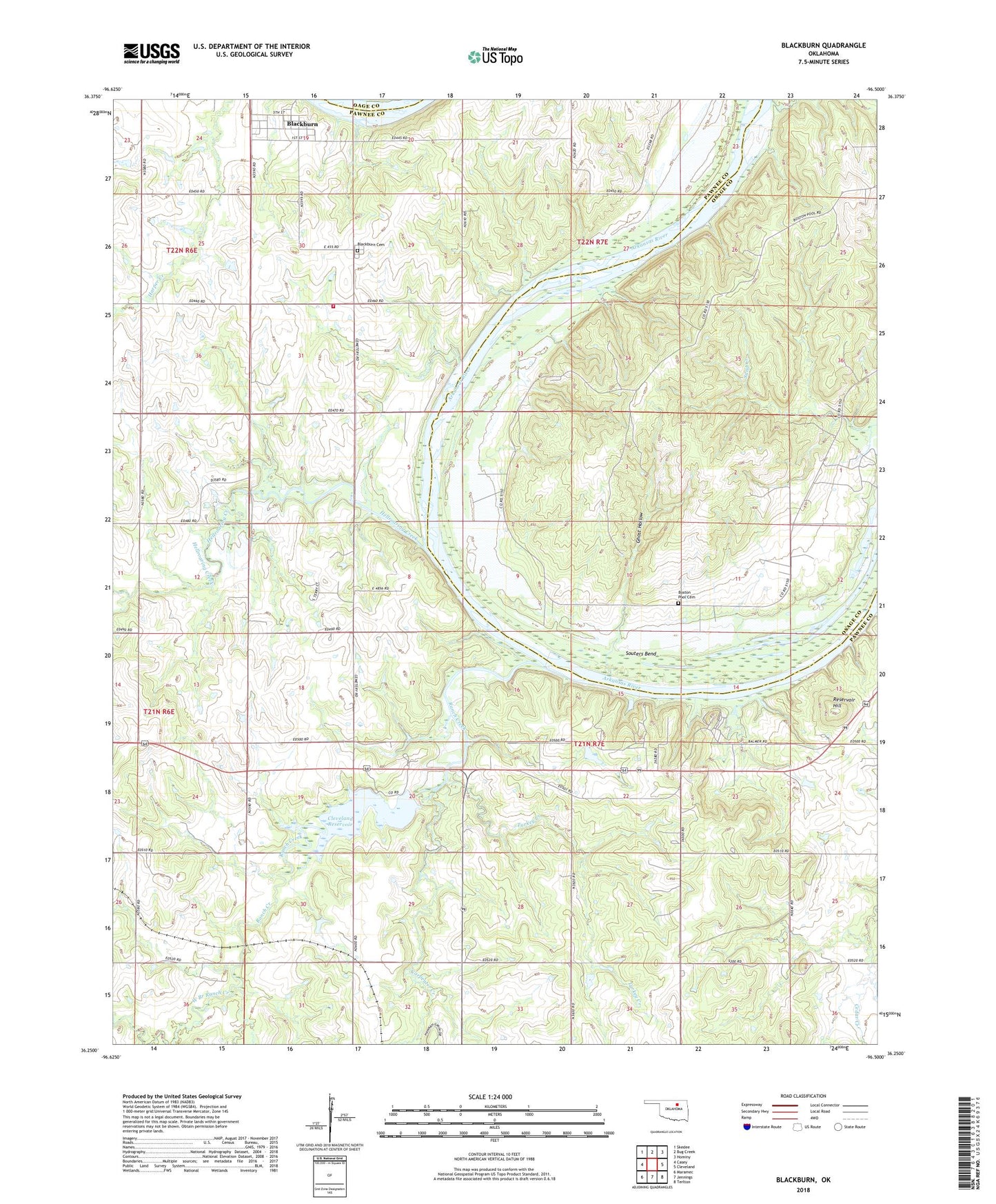
2022 topographic map quadrangle Blackburn in the state of Oklahoma. Scale: 1:24000. Based on the newly updated USGS 7.5' US Topo map series, this map is in the following counties: Pawnee, Osage. The map contains contour data, water features, and other items you are used to seeing on USGS maps, but also has updated roads and other features. This is the next generation of topographic maps. Printed on high-quality waterproof paper with UV fade-resistant inks.
Quads adjacent to this one:
West: Casey
Northwest: Skedee
North: Bug Creek
Northeast: Hominy
East: Cleveland
Southeast: Terlton
South: Jennings
Southwest: Maramec
This map covers the same area as the classic USGS quad with code o36096c5.
Contains the following named places: Blackburn, Blackburn Cemetery, Blackburn Rural Fire Department, Boston Pool Cemetery, Carpenter Creek, Cleveland Area Hospital Heliport, Cleveland Lake, Cleveland Lake Dam, Cleveland Reservoir, Eck Twin Lakes North Dam, Eck Twin Lakes North Reservoir, Ghost Hollow, Greenup Siding, Hellroaring Creek, Oknoname 113102 Dam, Oknoname 113102 Reservoir, Ranch Creek, Reservoir Hill, Souters Bend, Town of Blackburn, Township of Blackburn, Township of Valley, Turkey Creek, West Branch Ranch Creek, Will Rogers Camp