MyTopo
Concharty Mountain Oklahoma US Topo Map
Couldn't load pickup availability
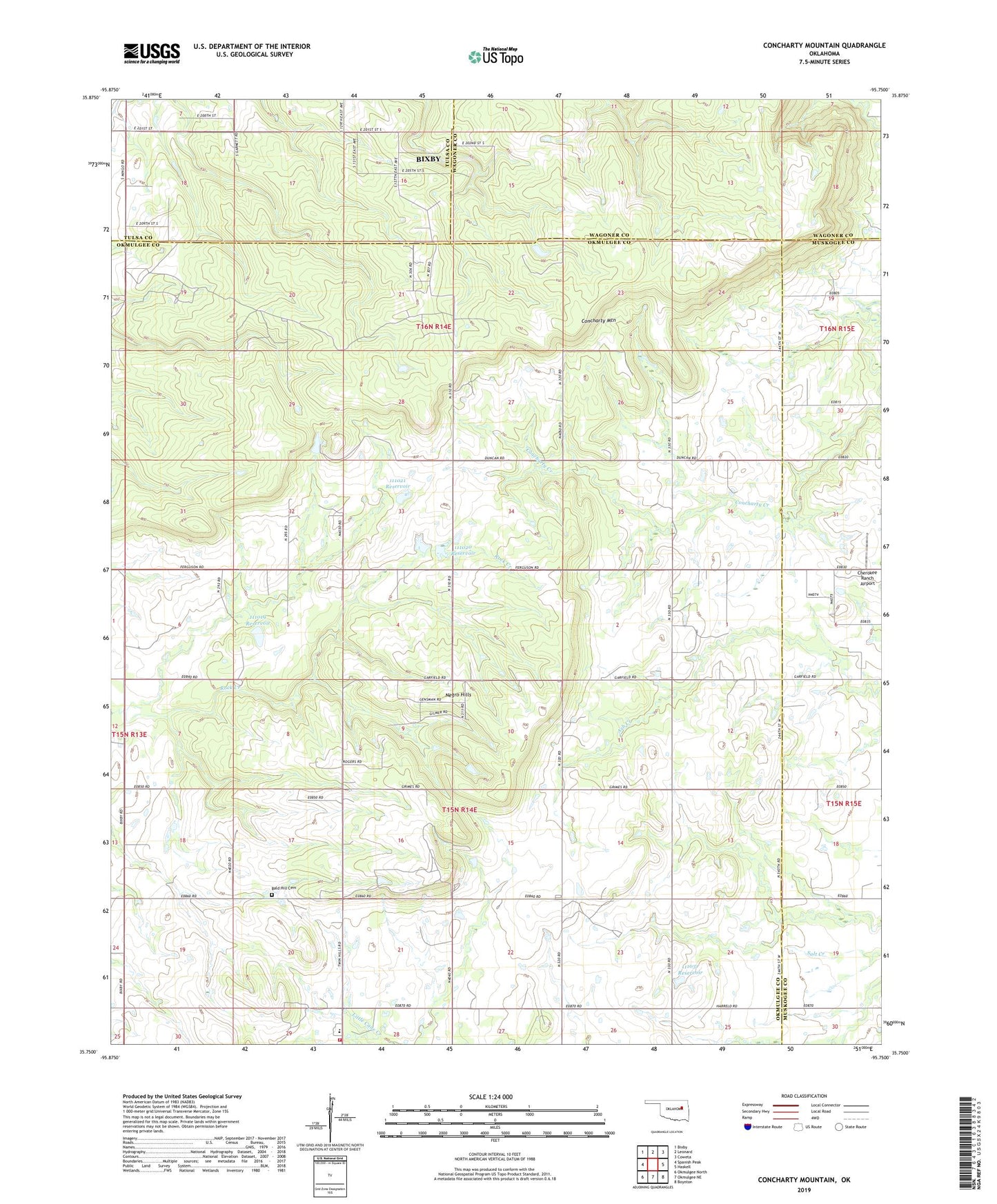
2019 topographic map quadrangle Concharty Mountain in the state of Oklahoma. Scale: 1:24000. Based on the newly updated USGS 7.5' US Topo map series, this map is in the following counties: Okmulgee, Muskogee, Wagoner, Tulsa. The map contains contour data, water features, and other items you are used to seeing on USGS maps, but also has updated roads and other features. This is the next generation of topographic maps. Printed on high-quality waterproof paper with UV fade-resistant inks.
Quads adjacent to this one:
West: Spanish Peak
Northwest: Bixby
North: Leonard
Northeast: Coweta
East: Haskell
Southeast: Boynton
South: Okmulgee NE
Southwest: Okmulgee North
Contains the following named places: Bald Hill Cemetery, Cherokee Ranch Airport, Concharty Church, Concharty Mountain, Harper Chapel, KAYI-FM (Muskogee), Morris Church, Negro Hills, Oknoname 111019 Dam, Oknoname 111019 Reservoir, Oknoname 111020 Reservoir, Oknoname 111021 Dam, Oknoname 111021 Reservoir, Oknoname 111031 Dam, Oknoname 111031 Reservoir, Oknoname 1111020 Dam, Township of Bryan, Twin Hills Elementary School, Twin Hills Volunteer Fire District