MyTopo
Okmulgee NE Oklahoma US Topo Map
Couldn't load pickup availability
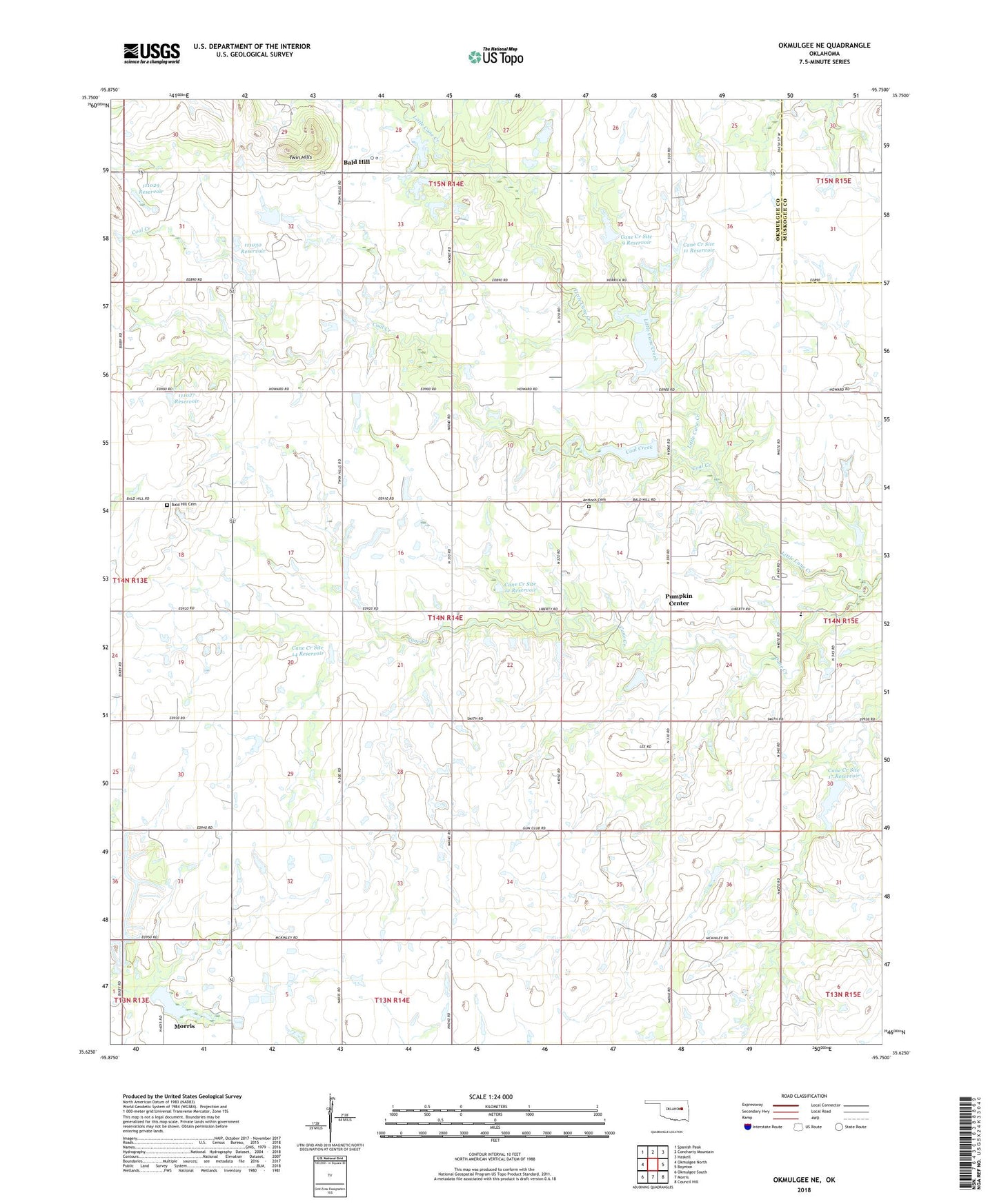
2022 topographic map quadrangle Okmulgee NE in the state of Oklahoma. Scale: 1:24000. Based on the newly updated USGS 7.5' US Topo map series, this map is in the following counties: Okmulgee, Muskogee. The map contains contour data, water features, and other items you are used to seeing on USGS maps, but also has updated roads and other features. This is the next generation of topographic maps. Printed on high-quality waterproof paper with UV fade-resistant inks.
Quads adjacent to this one:
West: Okmulgee North
Northwest: Spanish Peak
North: Concharty Mountain
Northeast: Haskell
East: Boynton
Southeast: Council Hill
South: Morris
Southwest: Okmulgee South
This map covers the same area as the classic USGS quad with code o35095f7.
Contains the following named places: Antioch Cemetery, Antioch Church, Ashley Airport, Bald Hill, Bald Hill Cemetery, Bald Hill Church, Cane Creek Site 11 Dam, Cane Creek Site 11 Reservoir, Cane Creek Site 12 Dam, Cane Creek Site 12 Reservoir, Cane Creek Site 14 Dam, Cane Creek Site 14 Reservoir, Cane Creek Site 15 Dam, Cane Creek Site 15 Reservoir, Cane Creek Site 17 Dam, Cane Creek Site 17 Reservoir, Cane Creek Site 7 Dam, Cane Creek Site 7 Reservoir, Cane Creek Site 9 Dam, Cane Creek Site 9 Reservoir, Coal Creek, Liberty Church, Liberty Elementary School, Little Cane Creek, Morris Dam, Morris Division, Morris Lake, Oknoname 111027 Dam, Oknoname 111027 Reservoir, Oknoname 111028 Dam, Oknoname 111028 Reservoir, Oknoname 111029 Dam, Oknoname 111029 Reservoir, Oknoname 111030 Dam, Oknoname 111030 Reservoir, Pumpkin Center, Sallisaw Creek Site 24 Dam, Sallisaw Creek Site 24 Reservoir, Township of Bald Hill, Twin Hills, ZIP Code: 74445