MyTopo
Spanish Peak Oklahoma US Topo Map
Couldn't load pickup availability
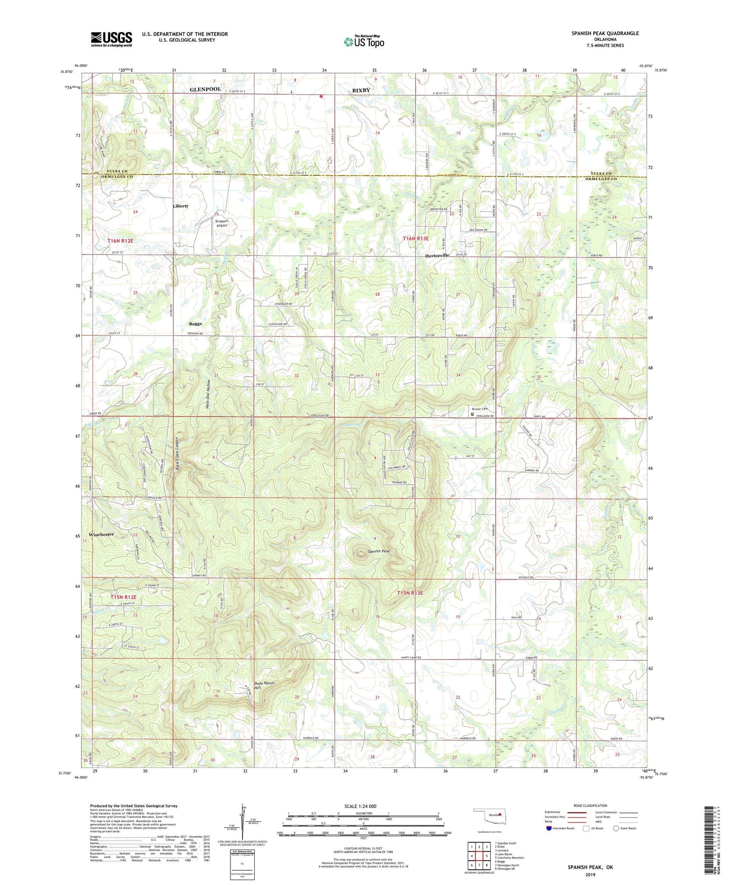
2022 topographic map quadrangle Spanish Peak in the state of Oklahoma. Scale: 1:24000. Based on the newly updated USGS 7.5' US Topo map series, this map is in the following counties: Okmulgee, Tulsa. The map contains contour data, water features, and other items you are used to seeing on USGS maps, but also has updated roads and other features. This is the next generation of topographic maps. Printed on high-quality waterproof paper with UV fade-resistant inks.
Quads adjacent to this one:
West: Lake Boren
Northwest: Sapulpa South
North: Bixby
Northeast: Leonard
East: Concharty Mountain
Southeast: Okmulgee NE
South: Okmulgee North
Southwest: Beggs
This map covers the same area as the classic USGS quad with code o35095g8.
Contains the following named places: Bruner Creek, Duck Creek Church, Dude Ranch Hill, Eagle Creek, Erroport Airport, Fleetwood Bruner Cemetery, Hectorville, Hectorville Church, Hoot Owl Hollow, Liberty, Liberty Area Fire Department, Liberty Elementary School, Liberty High School, Oknoname 111018 Dam, Oknoname 111018 Reservoir, Rock Creek, Rock Creek Canyon, Snake Creek Church, Spanish Peak, Town of Liberty, Town of Winchester, Township of Natura, Winchester