MyTopo
Haskell Oklahoma US Topo Map
Couldn't load pickup availability
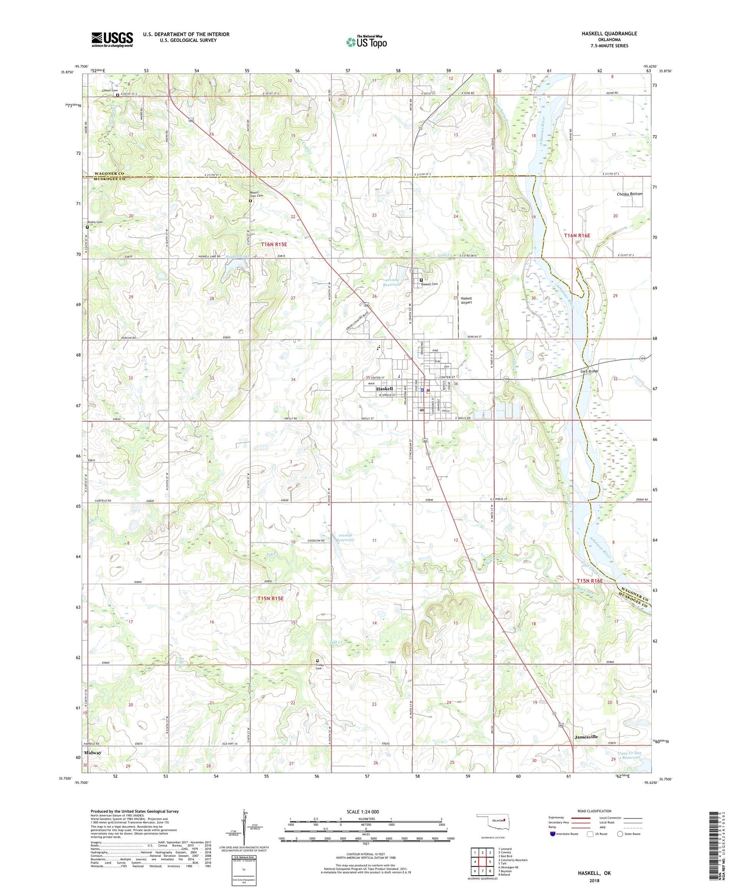
2022 topographic map quadrangle Haskell in the state of Oklahoma. Scale: 1:24000. Based on the newly updated USGS 7.5' US Topo map series, this map is in the following counties: Muskogee, Wagoner. The map contains contour data, water features, and other items you are used to seeing on USGS maps, but also has updated roads and other features. This is the next generation of topographic maps. Printed on high-quality waterproof paper with UV fade-resistant inks.
Quads adjacent to this one:
West: Concharty Mountain
Northwest: Leonard
North: Coweta
Northeast: Red Bird
East: Taft
Southeast: Beland
South: Boynton
Southwest: Okmulgee NE
This map covers the same area as the classic USGS quad with code o35095g6.
Contains the following named places: Ash Creek, Cane Creek Site 1 Dam, Cane Creek Site 1 Reservoir, Church of the Living God, Coal Creek, Coburn Lake, Coburn Lake Dam, Concharty Creek, Creek Church, Friday Cemetery, Gary Bridge, Gibson Cemetery, Haskell, Haskell Airport, Haskell Cemetery, Haskell Division, Haskell High School, Haskell Lake, Haskell Lake Dam, Haskell Middle School, Haskell Police Department, Haskell Post Office, Haskell Volunteer Fire Department, Jamesville, Mary White Elementary School, Midway, Midway Church, Mount Zion Cemetery, Mount Zion Church, Oknoname 101004 Dam, Oknoname 101004 Reservoir, Oknoname 101009 Dam, Oknoname 101009 Reservoir, Phyllis Cemetery, Pleasant Valley Church, Salt Creek, Simmons Chapel, Town of Haskell, Township of Moore, ZIP Code: 74436