MyTopo
Cookson Oklahoma US Topo Map
Couldn't load pickup availability
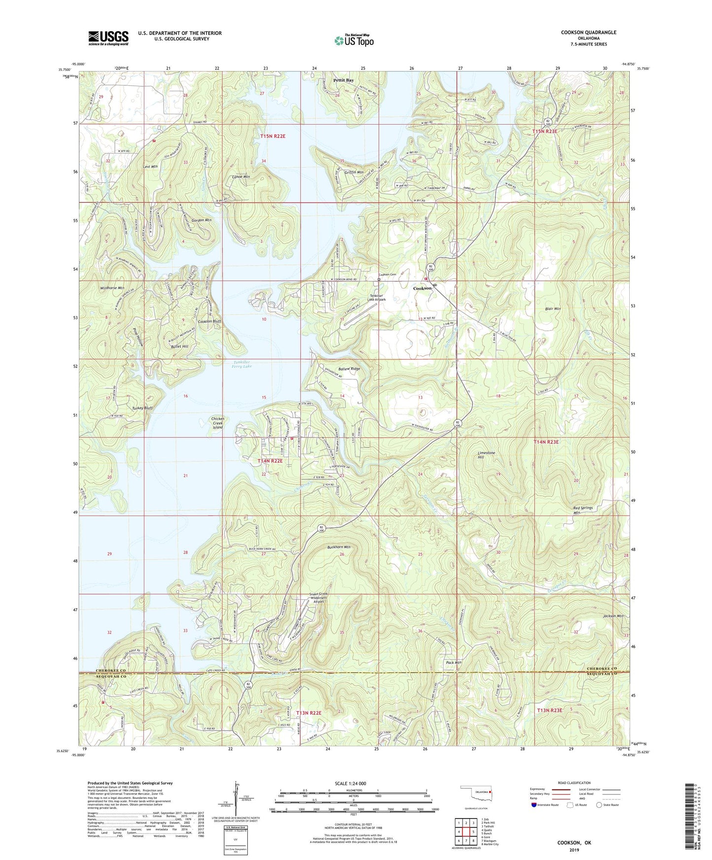
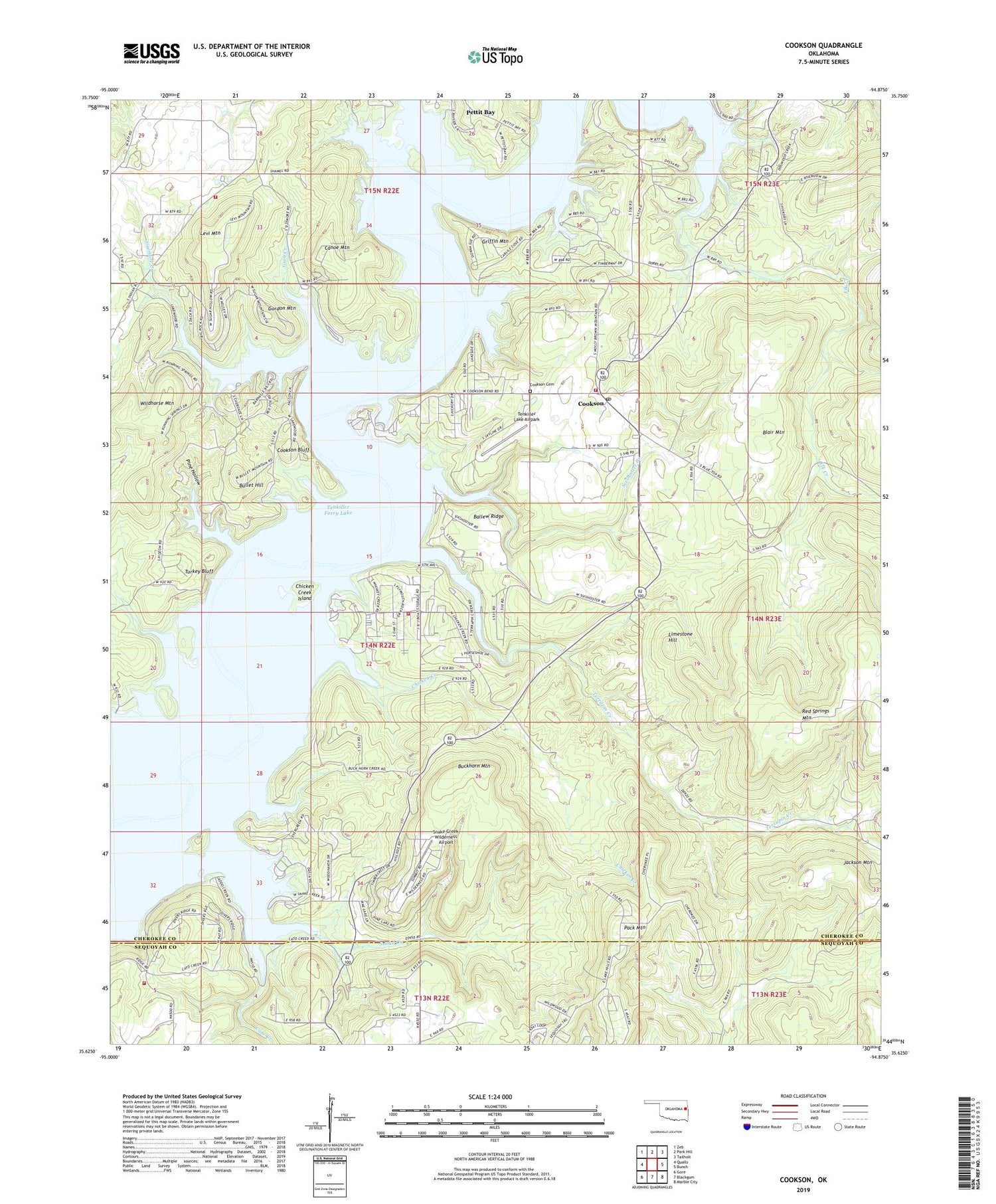
2019 topographic map quadrangle Cookson in the state of Oklahoma. Scale: 1:24000. Based on the newly updated USGS 7.5' US Topo map series, this map is in the following counties: Cherokee, Sequoyah. The map contains contour data, water features, and other items you are used to seeing on USGS maps, but also has updated roads and other features. This is the next generation of topographic maps. Printed on high-quality waterproof paper with UV fade-resistant inks.
Quads adjacent to this one:
West: Qualls
Northwest: Zeb
North: Park Hill
Northeast: Tailholt
East: Bunch
Southeast: Marble City
South: Blackgum
Southwest: Gore
Contains the following named places: Ballew Ridge, Ballew Ridge Public Use Area, Blackgum Landing Public Use Area, Blackgum Mountain Volunteer Fire Department Station 1 Headquarters, Buckhorn Mountain, Bullet Hill, Canoe Mountain, Carlisle Cove Public Use Area, Carlisle Inlet Public Use Area, Cato Creek, Cato Creek Landing Public Use Area, Chicken Creek, Chicken Creek Fire Department, Chicken Creek Island, Chicken Creek Point Public Use Area, Cookson, Cookson - Proctor Cemetery, Cookson Bend Public Use Area, Cookson Bluff, Cookson Bluff Public Use Area, Cookson Census Designated Place, Cookson Post Office, Cookson Volunteer Fire Department, Elk Creek, Gordon Mountain, Griffin Mountain, Gum Creek, Joliff Inlet Public Use Area, Keys Fire Department Station 2, Levi Mountain, Limestone Hill, Pack Mountain, Pine Hollow, Sisemore Creek, Sisemore Landing Public Use Area, Sixshooter Branch, Sixshooter Camp Public Use Area, Snake Creek, Snake Creek Cove Public Use Area, Snake Creek Wilderness Airport, Standing Rock Landing Public Use Area, Tenkiller Ferry Lake, Tenkiller Lake Airpark, Terrapin Creek, Township of Cookson, Turkey Bluff, Wildhorse Mountain, ZIP Codes: 74427, 74451