MyTopo
Blackgum Oklahoma US Topo Map
Couldn't load pickup availability
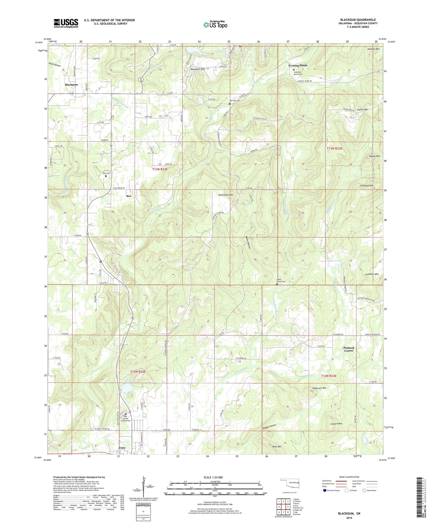
2022 topographic map quadrangle Blackgum in the state of Oklahoma. Scale: 1:24000. Based on the newly updated USGS 7.5' US Topo map series, this map is in the following counties: Sequoyah. The map contains contour data, water features, and other items you are used to seeing on USGS maps, but also has updated roads and other features. This is the next generation of topographic maps. Printed on high-quality waterproof paper with UV fade-resistant inks.
Quads adjacent to this one:
West: Gore
Northwest: Qualls
North: Cookson
Northeast: Bunch
East: Marble City
Southeast: Sallisaw
South: Vian
Southwest: Stigler NE
This map covers the same area as the classic USGS quad with code o35094e8.
Contains the following named places: Anderson Mountain, Barnoskie Cemetery, Blackgum, Blackgum Census Designated Place, Blackgum Mountain, Blackgum Mountain Volunteer Fire Department Station 2, Blackgum Mountain Volunteer Fire Department Station 3, Boggy Hollow, Box, Box Cemetery, Box Census Designated Place, Cedar Grove Cemetery, Cherokee - McCoy Cemetery, Chuculate Mountain, Cowhead Mountain, Evening Shade, Evening Shade Census Designated Place, Lizzard Mountain, Pinhook Corner, Pinhook Corner Census Designated Place, Pinhook Creek, Round Mountain, Sallisaw Creek Site 3 Dam, Sallisaw Creek Site 3 Reservoir, Sycamore, Sycamore Census Designated Place, Town of Vian, Township of Blackgum, Vian Creek Church, Vian Division, Vian Garden of Memories, Vian Lake, Wells Hollow, ZIP Code: 74962