MyTopo
Park Hill Oklahoma US Topo Map
Couldn't load pickup availability
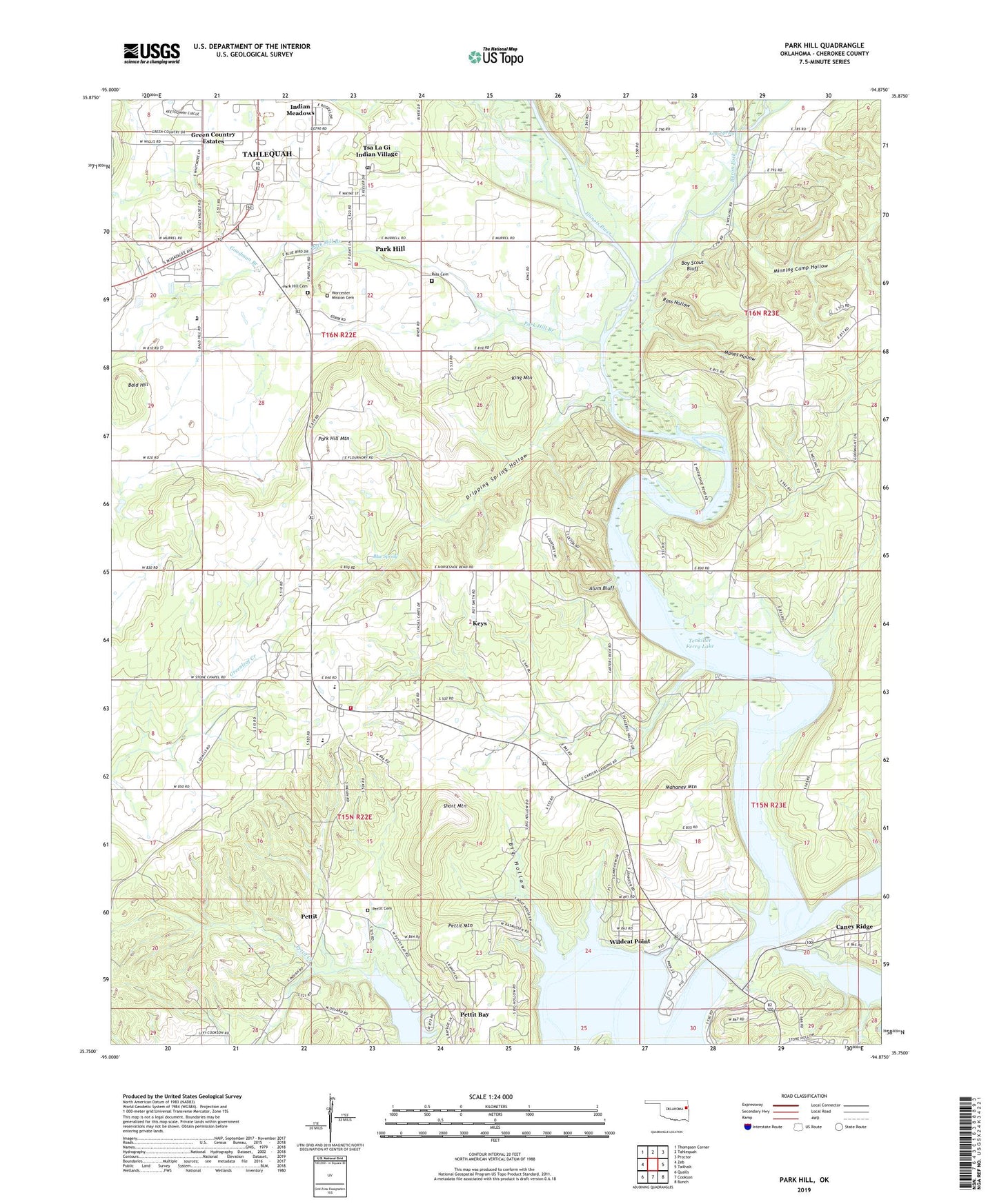
2022 topographic map quadrangle Park Hill in the state of Oklahoma. Scale: 1:24000. Based on the newly updated USGS 7.5' US Topo map series, this map is in the following counties: Cherokee. The map contains contour data, water features, and other items you are used to seeing on USGS maps, but also has updated roads and other features. This is the next generation of topographic maps. Printed on high-quality waterproof paper with UV fade-resistant inks.
Quads adjacent to this one:
West: Zeb
Northwest: Thompson Corner
North: Tahlequah
Northeast: Proctor
East: Tailholt
Southeast: Bunch
South: Cookson
Southwest: Qualls
This map covers the same area as the classic USGS quad with code o35094g8.
Contains the following named places: Alum Bluff, Bald Hill, Baron Fork, Big Hollow, Blue Spring, Boy Scout Bluff, Camp Darby, Caney Creek, Caney Ridge, Caney Ridge Census Designated Place, Carter Church, Carters Landing, Carters Landing Public Use Area, Cherokee Home Mission, Cherokee Landing State Park, Cherokee Nation Emergency Medical Services, Dripping Spring Hollow, Dry Creek, Elk Creek Landing Public Use Area, Etta, Etta Bend Public Use Area, Etta Census Designated Place, Etta Church, Goodman Branch, Green Country Estates, Horseshoe Bend Public Use Area, Indian Meadows, Keys, Keys Census Designated Place, Keys Elementary School, Keys Fire Department Station 1, Keys High School, Keys Mission Church, Keys Spring, King Mountain, Mahaney Mountain, Manes Hollow, Minning Camp Hollow, Murrell Home Park, Oklahoma Department of Agriculture Forestry Northeast Area, Park Hill, Park Hill Branch, Park Hill Cemetery, Park Hill Census Designated Place, Park Hill Mountain, Park Hill Post Office, Pettit, Pettit Bay, Pettit Bay Public Use Area, Pettit Cemetery, Pettit Census Designated Place, Pettit Creek, Pettit Mountain, Ross Cemetery, Ross Hollow, Short Mountain, Strayhorn Landing Public Use Area, Township of Park Hill, Tsa La Gi Indian Village, Turner Ford Camp, Welling Post Office, Wildcat Point, Worcester Mission Cemetery