MyTopo
Bunch Oklahoma US Topo Map
Couldn't load pickup availability
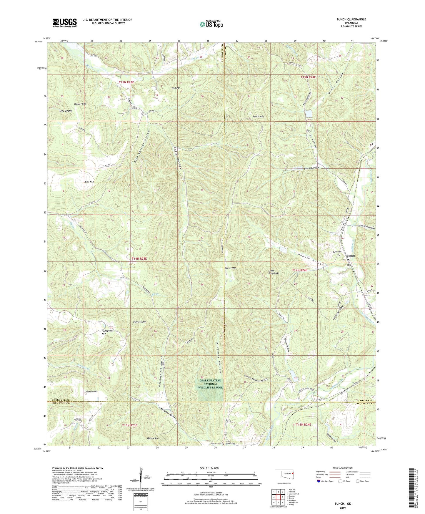
2022 topographic map quadrangle Bunch in the state of Oklahoma. Scale: 1:24000. Based on the newly updated USGS 7.5' US Topo map series, this map is in the following counties: Cherokee, Adair, Sequoyah. The map contains contour data, water features, and other items you are used to seeing on USGS maps, but also has updated roads and other features. This is the next generation of topographic maps. Printed on high-quality waterproof paper with UV fade-resistant inks.
Quads adjacent to this one:
West: Cookson
Northwest: Park Hill
North: Tailholt
Northeast: Stilwell West
East: Greasy
Southeast: Brushy
South: Marble City
Southwest: Blackgum
This map covers the same area as the classic USGS quad with code o35094f7.
Contains the following named places: Beaver Lookout Tower, Beaver Mountain, Blair Mountain, Blaylock Mountain, Bolin Hollow, Bunch, Bunch Cemetery, Bunch Mountain, Bunch Post Office, Buzzard Hollow, Cave Spring Census Designated Place, Cave Springs Church, Cave Springs Elementary / Middle School, Cave Springs High School, Cherokee School, Cookson Hills State Game Refuge, Dry Creek, Dry Creek Census Designated Place, Fat Horse Hollow, Flute Springs, Flute Springs Cemetery, Goldmine Hollow, Hamlin Hollow, Hastings Hollow, Henderson School, Hopper Flat, Jackson Mountain, Lead Mine Hollow, Little Round Mountain, Log Cabin Church, Malloy Hollow, Owl Mountain, Pipe Springs Hollow, Red Springs Mountain, Rider Hollow, Sallisaw Creek Site 12 Dam, Sallisaw Creek Site 12 Reservoir, Sallisaw Creek Site 13 Dam, Sallisaw Creek Site 13 Reservoir, Sallisaw Creek Site 14 Dam, Sallisaw Creek Site 14 Reservoir, Sallisaw Creek Site 15 Dam, Sallisaw Creek Site 15 Reservoir, Sallisaw Creek Site 23 Dam, Sallisaw Creek Site 23 Reservoir, Sallisaw Creek Site 27 Dam, Sallisaw Creek Site 27 Reservoir, Smith Hollow, Teague Hollow, Township of Bunch, Walkingstick Hollow