MyTopo
Covington Oklahoma US Topo Map
Couldn't load pickup availability
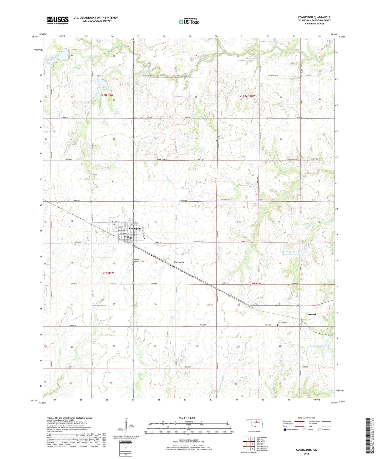
2018 topographic map quadrangle Covington in the state of Oklahoma. Scale: 1:24000. Based on the newly updated USGS 7.5' US Topo map series, this map is in the following counties: Garfield. The map contains contour data, water features, and other items you are used to seeing on USGS maps, but also has updated roads and other features. This is the next generation of topographic maps. Printed on high-quality waterproof paper with UV fade-resistant inks.
Quads adjacent to this one:
West: Fairmont
Northwest: Breckinridge
North: Garber
Northeast: Perry NW
East: Lucien
Southeast: Orlando West
South: Marshall East
Southwest: Marshall West
Contains the following named places: Cade's Airport, Callahan, Covington, Covington - Douglas Elementary School, Covington - Douglas High School, Covington Community Cemetery, Covington Police Department, Covington Post Office, Covington Volunteer Fire and Rescue, Crow Creek, Elmdale School, Hayward, Hayward Cemetery, Hayward Lake, Our Church, Saint John Cemetery, Town of Covington, Township of Otter, Township of Wood, Upper Black Bear Creek Site 39 Dam, Upper Black Bear Creek Site 39 Reservoir, Upper Black Bear Creek Site 40 Dam, Upper Black Bear Creek Site 40 Reservoir, Upper Black Bear Creek Site 42 Dam, Upper Black Bear Creek Site 42 Reservoir, ZIP Code: 73730