MyTopo
Marshall East Oklahoma US Topo Map
Couldn't load pickup availability
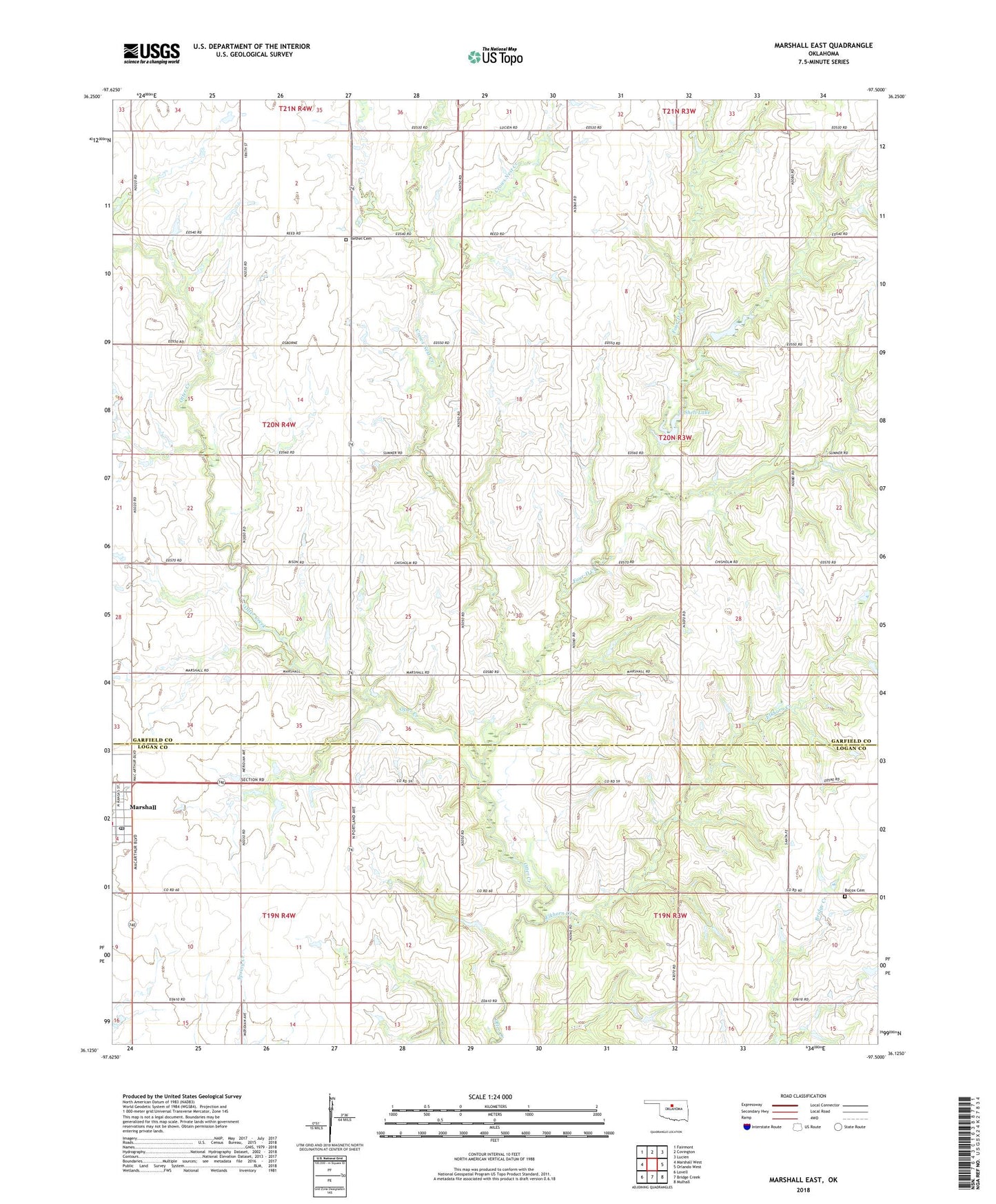
2022 topographic map quadrangle Marshall East in the state of Oklahoma. Scale: 1:24000. Based on the newly updated USGS 7.5' US Topo map series, this map is in the following counties: Garfield, Logan. The map contains contour data, water features, and other items you are used to seeing on USGS maps, but also has updated roads and other features. This is the next generation of topographic maps. Printed on high-quality waterproof paper with UV fade-resistant inks.
Quads adjacent to this one:
West: Marshall West
Northwest: Fairmont
North: Covington
Northeast: Lucien
East: Orlando West
Southeast: Mulhall
South: Bridge Creek
Southwest: Lovell
This map covers the same area as the classic USGS quad with code o36097b5.
Contains the following named places: Bethel Cemetery, Bocox Cemetery, Crows Nest Creek, Elkhorn Creek, Four-D Creek, Marshall Post Office, Shell Lake, Shell Lake Dam, Town of Marshall, Township of Marshall, Township of Reed