MyTopo
Marshall West Oklahoma US Topo Map
Couldn't load pickup availability
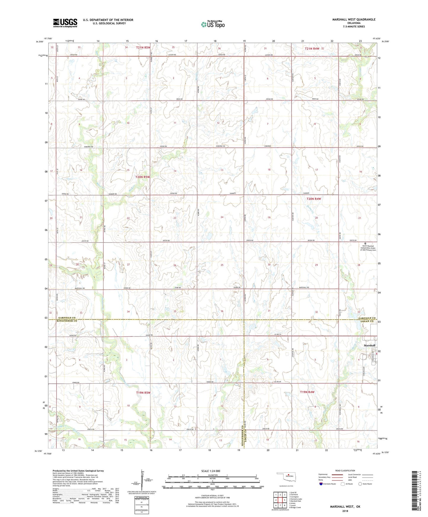
2022 topographic map quadrangle Marshall West in the state of Oklahoma. Scale: 1:24000. Based on the newly updated USGS 7.5' US Topo map series, this map is in the following counties: Garfield, Kingfisher, Logan. The map contains contour data, water features, and other items you are used to seeing on USGS maps, but also has updated roads and other features. This is the next generation of topographic maps. Printed on high-quality waterproof paper with UV fade-resistant inks.
Quads adjacent to this one:
West: Steinerts Lake
Northwest: Enid SE
North: Fairmont
Northeast: Covington
East: Marshall East
Southeast: Bridge Creek
South: Lovell
Southwest: Union
This map covers the same area as the classic USGS quad with code o36097b6.
Contains the following named places: Bitter Creek, Camp Creek, Marshall, Marshall Volunteer Fire Department, North Marshall Independent Order of Odd Fellows Cemetery, Township of Flynn, Wolf Creek, ZIP Code: 73056