MyTopo
Crescent Oklahoma US Topo Map
Couldn't load pickup availability
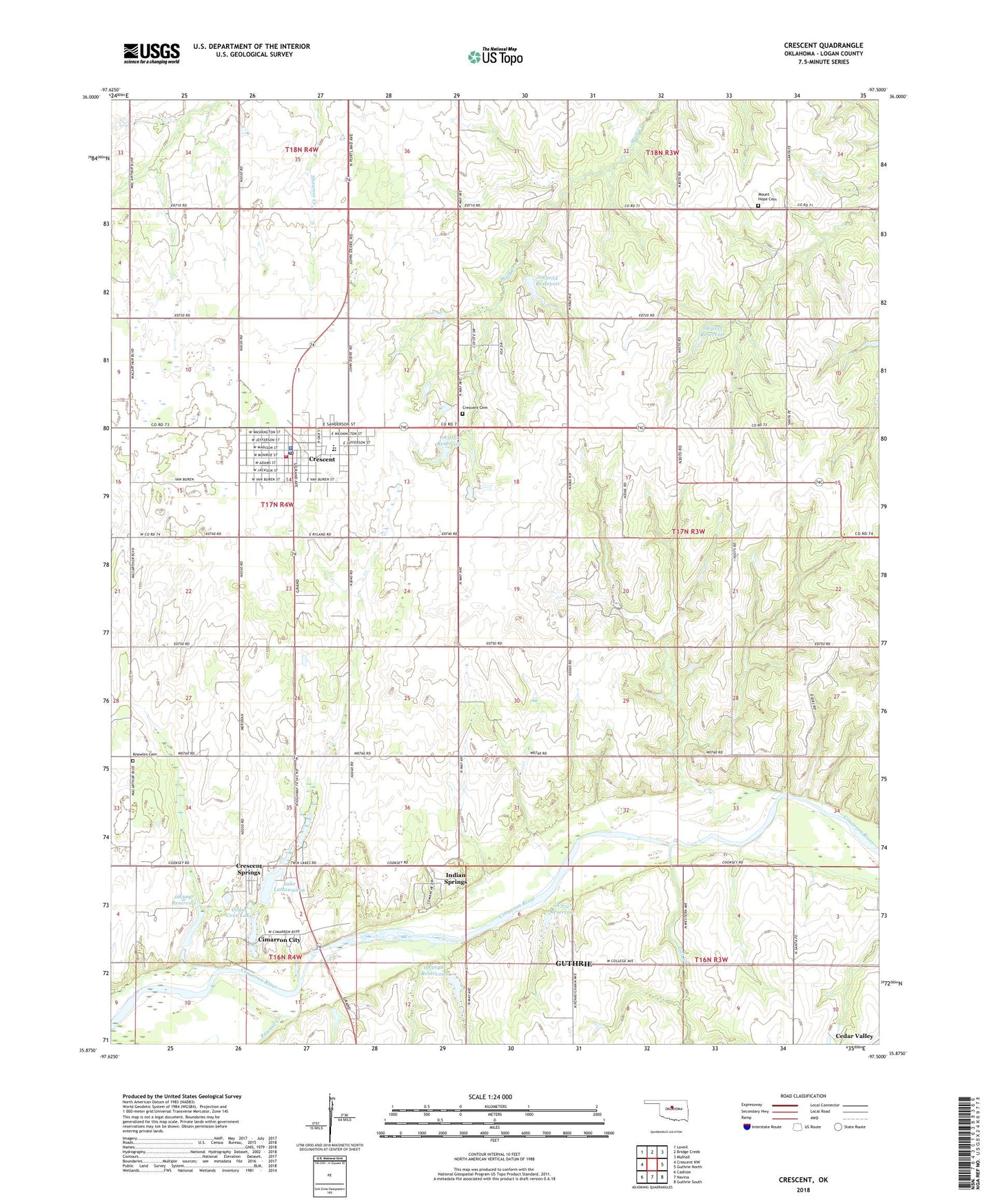
2018 topographic map quadrangle Crescent in the state of Oklahoma. Scale: 1:24000. Based on the newly updated USGS 7.5' US Topo map series, this map is in the following counties: Logan. The map contains contour data, water features, and other items you are used to seeing on USGS maps, but also has updated roads and other features. This is the next generation of topographic maps. Printed on high-quality waterproof paper with UV fade-resistant inks.
Quads adjacent to this one:
West: Crescent NW
Northwest: Lovell
North: Bridge Creek
Northeast: Mulhall
East: Guthrie North
Southeast: Guthrie South
South: Navina
Southwest: Cashion
Contains the following named places: Alttawanna Dam, Assembly of God Church, Baptist Church, Cedar Cove Dam, Cedar Cove Lake, Central Church, Cimarron City, City of Crescent, Crescent, Crescent Cemetery, Crescent Division, Crescent Elementary School, Crescent Emergency Medical Service, Crescent Fire Department, Crescent High School, Crescent Middle School, Crescent Police Department, Crescent Post Office, Crescent Springs, Crescent Springs Census Designated Place, East Lovell Oil Field, First Christian Church, First United Methodist Church, Gar Creek, Immanuel Covenant Church, Indian Springs, Jefferson Street First Baptist, Knowles Cemetery, Lake Lattawanna, Madison Street Church of God, Mount Hope Cemetery, Mount Vernon United Methodist Church, Myers Airport, Nazarene Church, Northeast Crescent Oil Field, Oknoname 083027 Dam, Oknoname 083027 Reservoir, Oknoname 083034 Dam, Oknoname 083034 Reservoir, Oknoname 083035 Dam, Oknoname 083035 Reservoir, Oknoname 083038 Dam, Oknoname 083038 Reservoir, Oknoname 083047 Dam, Oknoname 083047 Reservoir, Oknoname 083048 Dam, Oknoname 083048 Reservoir, Oknoname 083049 Dam, Oknoname 083049 Reservoir, Oknoname 083051 Dam, Oknoname 083051 Reservoir, Pawnee Creek, Saint Margaret Mary Church, Sky High Airport, Town of Cimarron City, Township of Crescent, Township of Woodland