MyTopo
Guthrie North Oklahoma US Topo Map
Couldn't load pickup availability
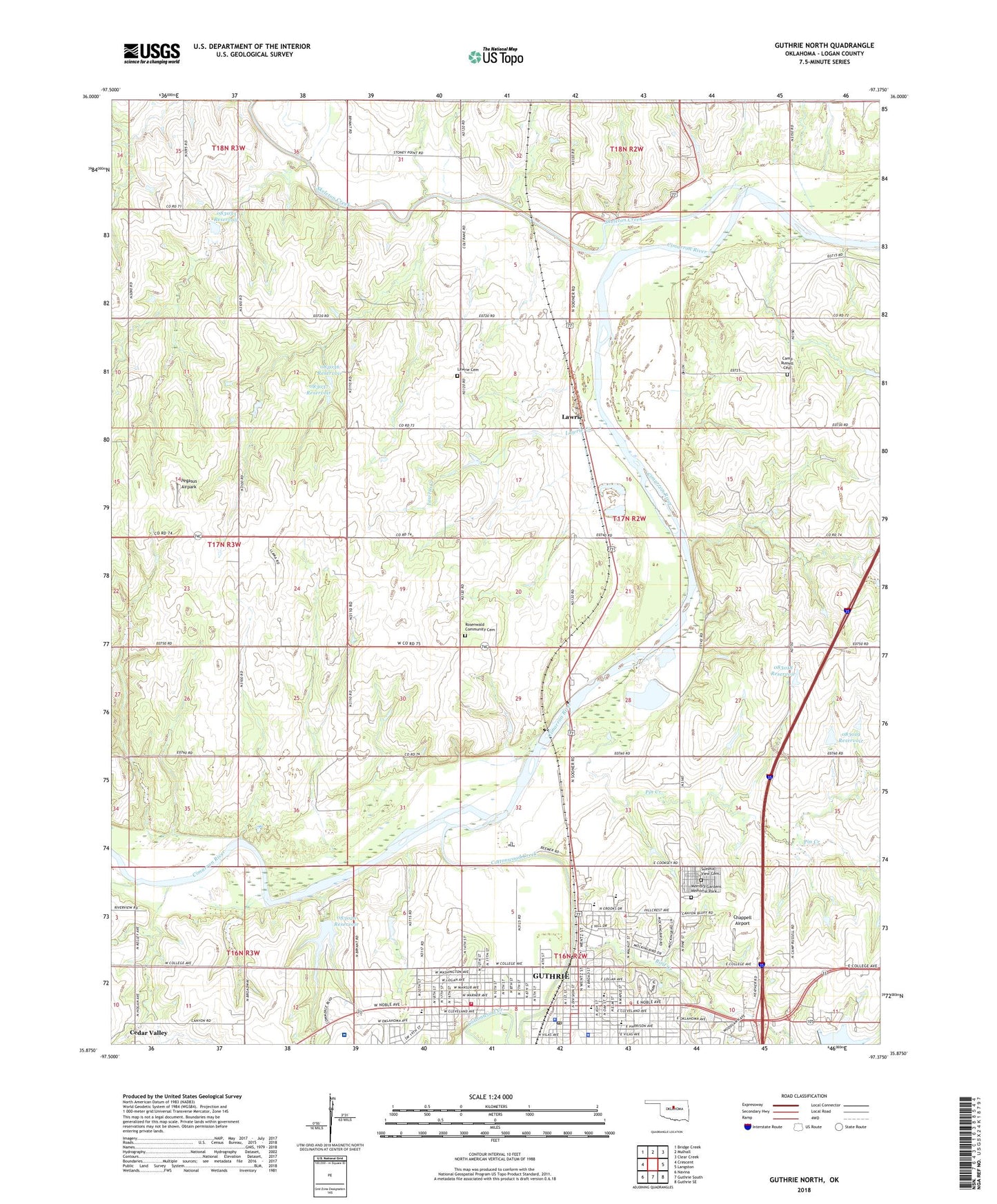
2022 topographic map quadrangle Guthrie North in the state of Oklahoma. Scale: 1:24000. Based on the newly updated USGS 7.5' US Topo map series, this map is in the following counties: Logan. The map contains contour data, water features, and other items you are used to seeing on USGS maps, but also has updated roads and other features. This is the next generation of topographic maps. Printed on high-quality waterproof paper with UV fade-resistant inks.
Quads adjacent to this one:
West: Crescent
Northwest: Bridge Creek
North: Mulhall
Northeast: Clear Creek
East: Langston
Southeast: Guthrie SE
South: Guthrie South
Southwest: Navina
This map covers the same area as the classic USGS quad with code o35097h4.
Contains the following named places: Abell Church, Assembly of God Church, Banner School, Bird Creek, Camp Joy, Camp Russell, Camp Russell Cemetery, Capitol School, Central Elementary School, Chappell Airport, Church of Christ, Cotteral Elementary School, Cottonwood Creek, Finn Creek Site 1 Dam, Finn Creek Site 1 Reservoir, Finn Creek Site 9 Dam, Finn Creek Site 9 Reservoir, First Christian Church, First Southern Baptist Church, First United Methodist Church, First United Presbyterian Church, Fogarty Elementary School, Guthrie, Guthrie Christian Church, Guthrie Country Club, Guthrie Country Club Lake, Guthrie Country Club Lake Dam, Guthrie Fire and Emergency Medical Services Station 2, Guthrie High School, Guthrie Historic District, Guthrie Junior High School, Guthrie Police Department, Guthrie Post Office, Guthrie Upper Elementary School, Highland Park, Kingdom Hall Jehovas Witness Church, KOKC-AM (Guthrie), Lawrie, Lawrie Cemetery, Lawrie Creek, Logan County, Logan County Jail, Logan County Sheriff's Department, Masonic Temple, Memory Gardens Memorial Park, Mercy Hospital Logan County, Mount Zion Baptist Church, Noble Avenue Baptist Church, Noble Park, Oknoname 083018 Dam, Oknoname 083018 Reservoir, Oknoname 083019 Dam, Oknoname 083019 Reservoir, Oknoname 083026 Dam, Oknoname 083026 Reservoir, Oknoname 083033 Dam, Oknoname 083033 Reservoir, Oknoname 083036 Dam, Oknoname 083036 Reservoir, Oknoname 083037 Dam, Oknoname 083037 Reservoir, Oknoname 087053 Dam, Oknoname 087053 Reservoir, Our Savior Lutheran Church, Pegasus Airpark, Pilgrim Rest Church, Pin Creek, Rosenwald Community Cemetery, Saint Marys Catholic Church, Saint Mary's Catholic School, Skeleton Creek, Summit View Cemetery, Taylor Mitchell 1 Dam, Taylor Mitchell 1 Reservoir, Taylor Mitchell 2 Dam, Taylor Mitchell 2 Reservoir, Township of Guthrie, Township of Lawrie, Trinity Episcopal Church, United Pentecostal Church, West Guthrie United Methodist Church, West Lawrie Oil Field, Word of Faith Pentecostal Church, Zion Lutheran Church