MyTopo
Mulhall Oklahoma US Topo Map
Couldn't load pickup availability
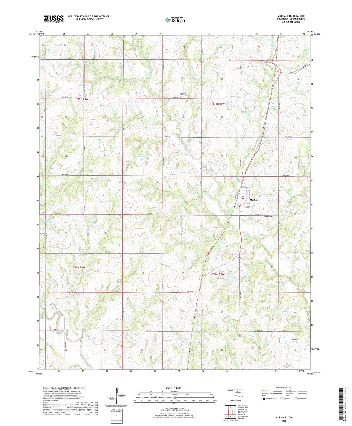
2022 topographic map quadrangle Mulhall in the state of Oklahoma. Scale: 1:24000. Based on the newly updated USGS 7.5' US Topo map series, this map is in the following counties: Logan. The map contains contour data, water features, and other items you are used to seeing on USGS maps, but also has updated roads and other features. This is the next generation of topographic maps. Printed on high-quality waterproof paper with UV fade-resistant inks.
Quads adjacent to this one:
West: Bridge Creek
Northwest: Marshall East
North: Orlando West
Northeast: Orlando East
East: Clear Creek
Southeast: Langston
South: Guthrie North
Southwest: Crescent
This map covers the same area as the classic USGS quad with code o36097a4.
Contains the following named places: Barnes, East Beaver Creek, Middle Beaver Creek, Mulhall, Mulhall - Orlando Elementary School, Mulhall Post Office, Mulhall Volunteer Fire Department, North Logan Division, Oknoname 083021 Dam, Oknoname 083021 Reservoir, Oknoname 083040 Dam, Oknoname 083040 Reservoir, Pleasant Valley Cemetery, Roselawn Cemetery, Township of Mulhall, Township of Orlando, West Beaver Creek, Wolf Creek, ZIP Code: 73063