MyTopo
Denton Oklahoma US Topo Map
Couldn't load pickup availability
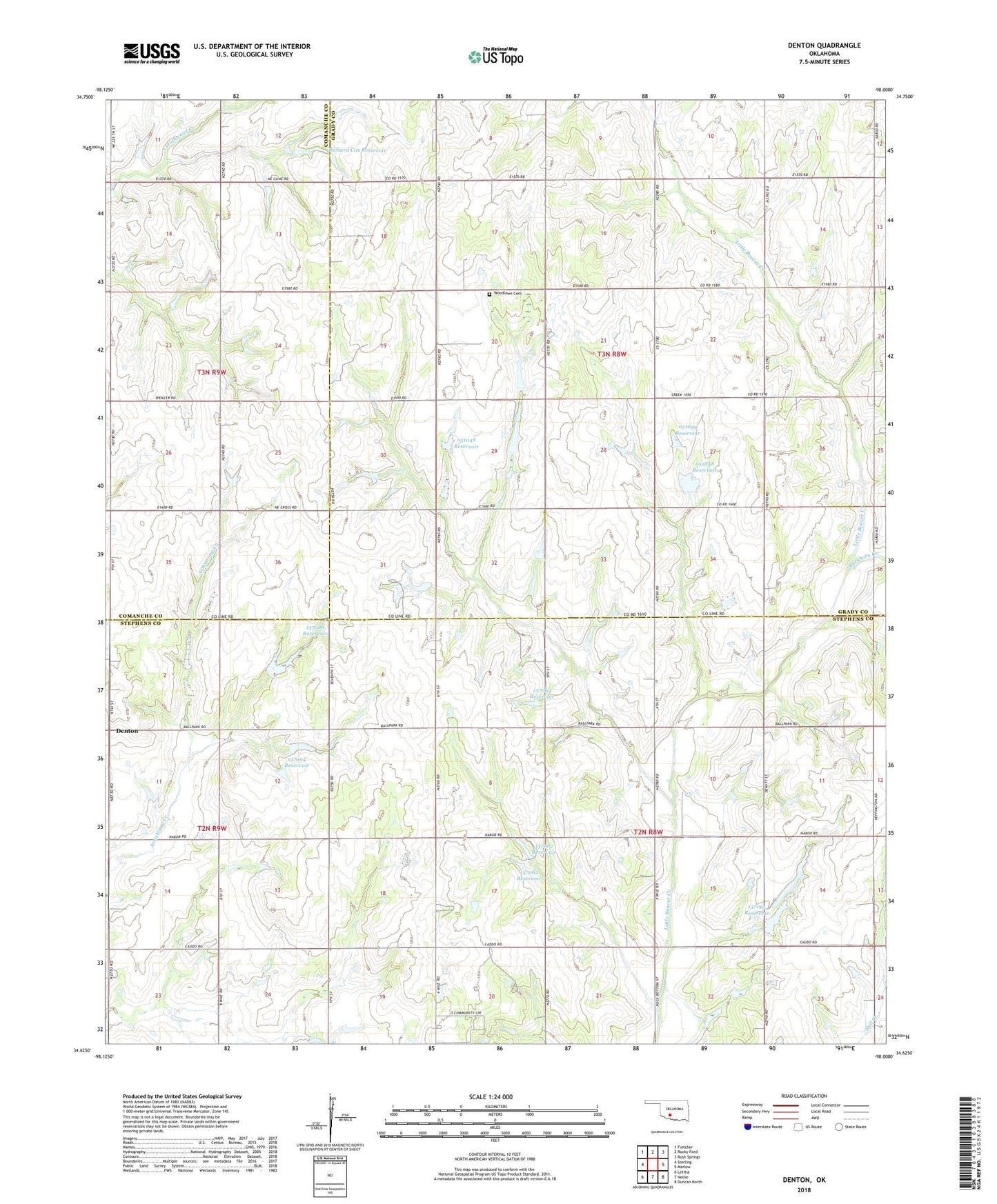
2018 topographic map quadrangle Denton in the state of Oklahoma. Scale: 1:24000. Based on the newly updated USGS 7.5' US Topo map series, this map is in the following counties: Stephens, Grady, Comanche. The map contains contour data, water features, and other items you are used to seeing on USGS maps, but also has updated roads and other features. This is the next generation of topographic maps. Printed on high-quality waterproof paper with UV fade-resistant inks.
Quads adjacent to this one:
West: Sterling
Northwest: Fletcher
North: Rocky Ford
Northeast: Rush Springs
East: Marlow
Southeast: Duncan North
South: Nellie
Southwest: Letitia
Contains the following named places: Buckhorn Creek, Denton, Hurley Grove Community House, KFXI-FM (Marlow), Oknoname 051048 Dam, Oknoname 051048 Reservoir, Oknoname 051058 Dam, Oknoname 051058 Reservoir, Oknoname 051059 Dam, Oknoname 051059 Reservoir, Oknoname 137002 Dam, Oknoname 137002 Reservoir, Oknoname 137003 Dam, Oknoname 137003 Reservoir, Oknoname 137004 Dam, Oknoname 137004 Reservoir, Oknoname 137061 Dam, Oknoname 137061 Reservoir, Oknoname 137062 Dam, Oknoname 137062 Reservoir, Oknoname 137063 Dam, Oknoname 137063 Reservoir, Oknoname 137064 Dam, Oknoname 137064 Reservoir, Oknoname 137088 Dam, Oknoname 137088 Reservoir, Richard Cox Dam, Richard Cox Reservoir, Township of Starr, Woodlawn Cemetery, Woodlawn Church