MyTopo
Letitia Oklahoma US Topo Map
Couldn't load pickup availability
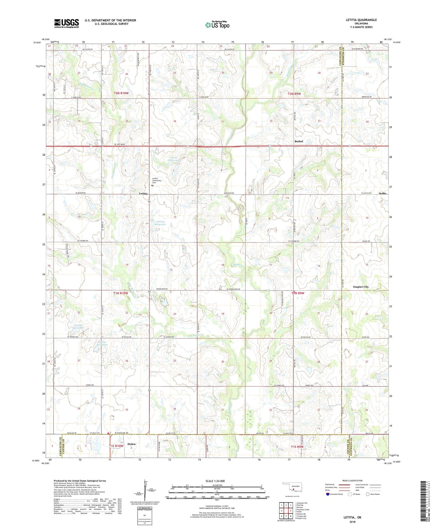
2022 topographic map quadrangle Letitia in the state of Oklahoma. Scale: 1:24000. Based on the newly updated USGS 7.5' US Topo map series, this map is in the following counties: Comanche, Stephens, Cotton. The map contains contour data, water features, and other items you are used to seeing on USGS maps, but also has updated roads and other features. This is the next generation of topographic maps. Printed on high-quality waterproof paper with UV fade-resistant inks.
Quads adjacent to this one:
West: Ninemile Creek
Northwest: Arbuckle Hill
North: Sterling
Northeast: Denton
East: Nellie
Southeast: Empire City
South: Temple NW
Southwest: Walters NE
This map covers the same area as the classic USGS quad with code o34098e2.
Contains the following named places: Armstrong Creek, Ash Grove School, Beaver Bend School, Bethel, Bethel Road Volunteer Fire Department, Dry Beaver Creek, Fairview School, Hulen, Hulen Church, Hulen Volunteer Fire Department, KMGZ-FM (Lawton), Letitia, Letitia Community Cemetery, Messing School, Ninemile Beaver Creek, Oknoname 031031 Dam, Oknoname 031031 Reservoir, Oknoname 031032 Dam, Oknoname 031032 Reservoir, Oknoname 031034 Dam, Oknoname 031034 Reservoir, Oknoname 031035 Dam, Oknoname 031035 Reservoir, Oknoname 031055 Reservoir, Oknoname 031056 Dam, Oknoname 031057 Dam, Oknoname 031057 Reservoir, Pleasant Valley Community House, Pumpkin Center, Rock Creek Church, Township of Hulen