MyTopo
Eakly Oklahoma US Topo Map
Couldn't load pickup availability
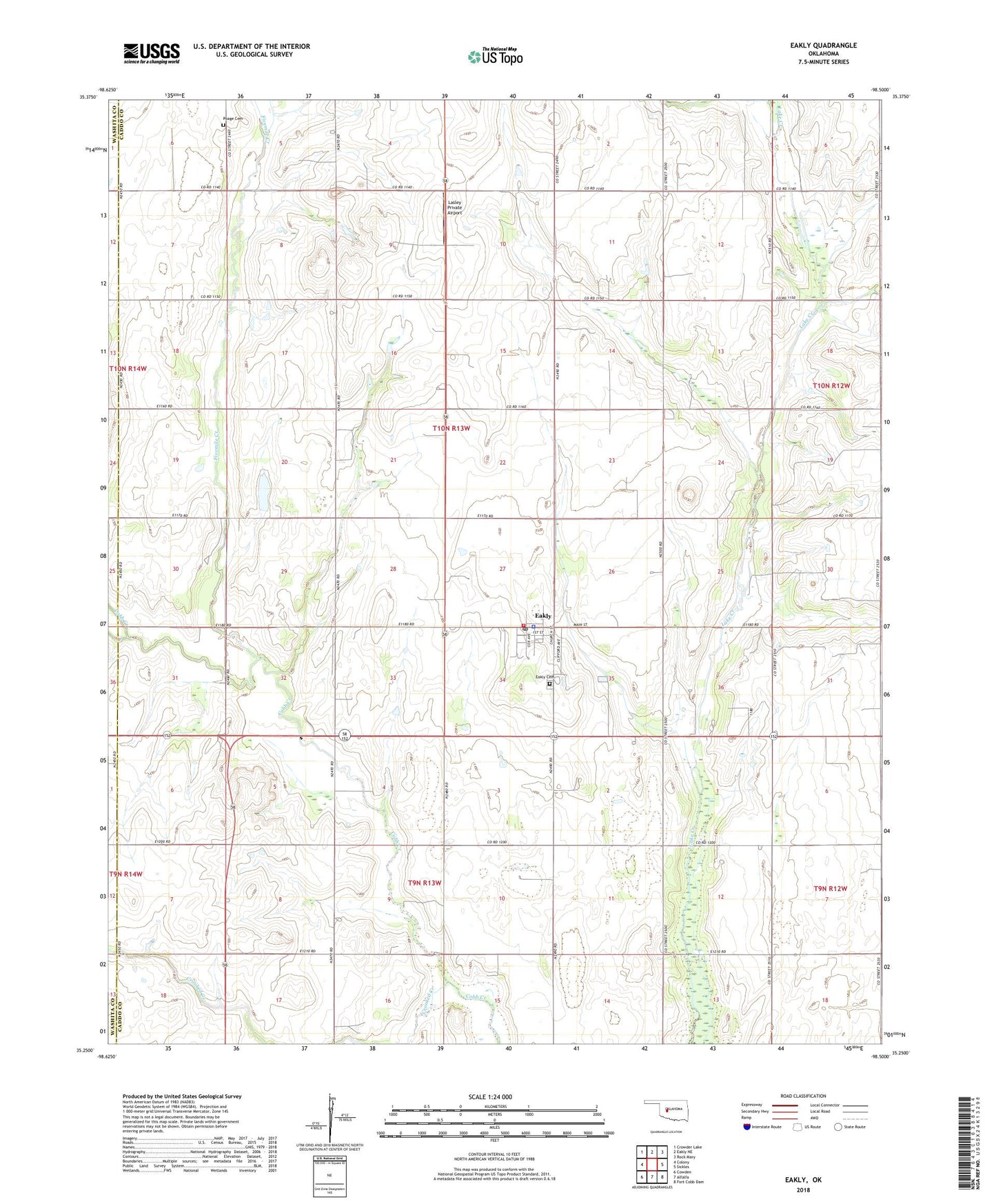
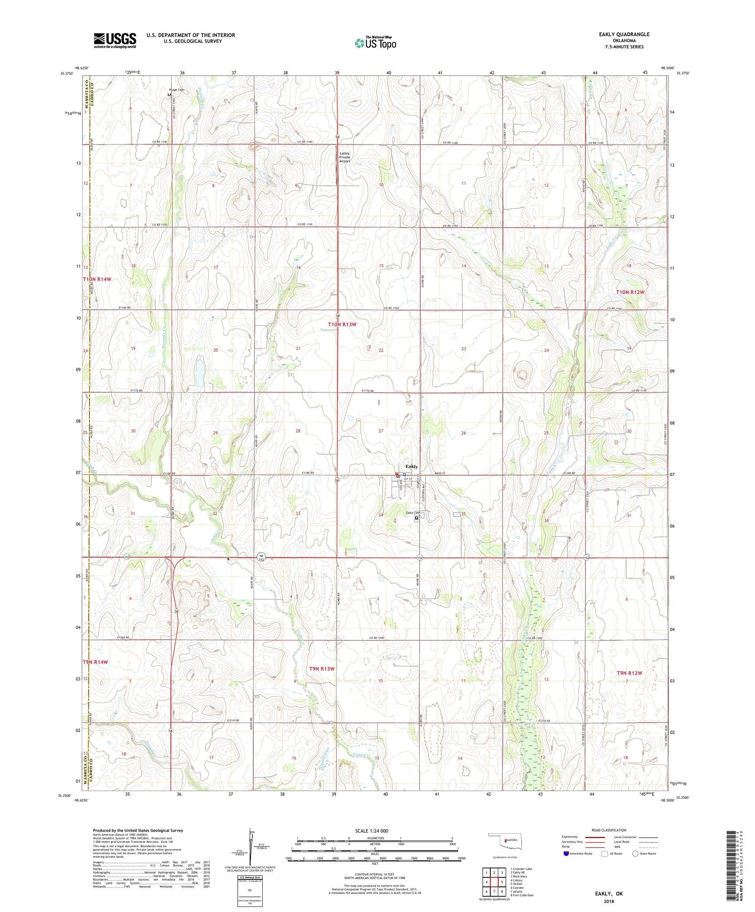
2018 topographic map quadrangle Eakly in the state of Oklahoma. Scale: 1:24000. Based on the newly updated USGS 7.5' US Topo map series, this map is in the following counties: Caddo, Washita. The map contains contour data, water features, and other items you are used to seeing on USGS maps, but also has updated roads and other features. This is the next generation of topographic maps. Printed on high-quality waterproof paper with UV fade-resistant inks.
Quads adjacent to this one:
West: Colony
Northwest: Crowder Lake
North: Eakly NE
Northeast: Rock Mary
East: Sickles
Southeast: Fort Cobb Dam
South: Alfalfa
Southwest: Cowden
Contains the following named places: Buck Creek, Crooked Creek, Eakly, Eakly Cemetery, Eakly Elementary School, Eakly Fire Department, Eakly Police Department, Eakly Post Office, Fairview Church, Fivemile Creek, Lasley Private Airport, Oakdale Church, Poage Cemetery, Town of Eakly, Township of Beaver, Wheeler Landing Strip, ZIP Code: 73033