MyTopo
Elgin Oklahoma US Topo Map
Couldn't load pickup availability
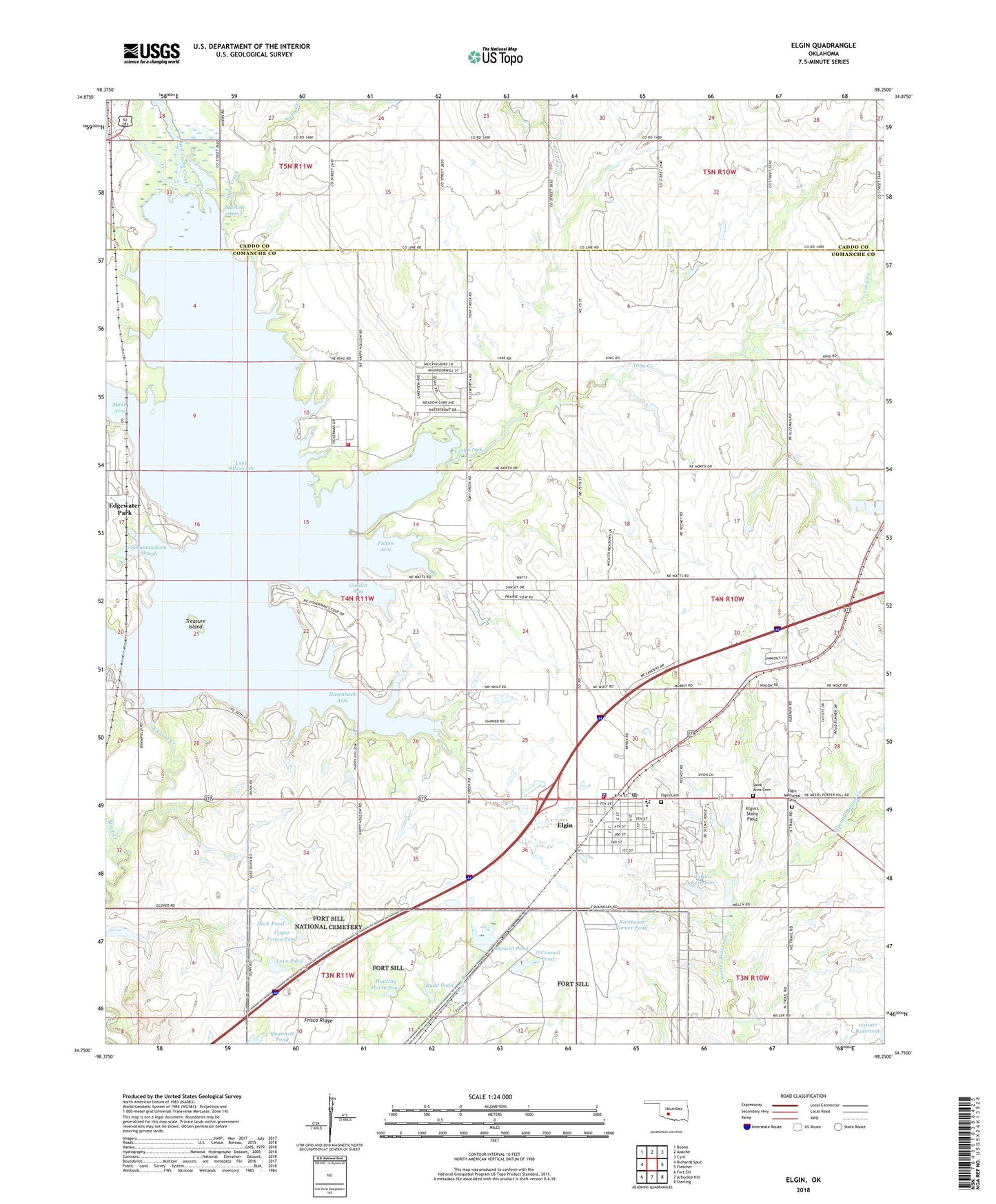
2018 topographic map quadrangle Elgin in the state of Oklahoma. Scale: 1:24000. Based on the newly updated USGS 7.5' US Topo map series, this map is in the following counties: Comanche, Caddo. The map contains contour data, water features, and other items you are used to seeing on USGS maps, but also has updated roads and other features. This is the next generation of topographic maps. Printed on high-quality waterproof paper with UV fade-resistant inks.
Quads adjacent to this one:
West: Richards Spur
Northwest: Boone
North: Apache
Northeast: Cyril
East: Fletcher
Southeast: Sterling
South: Arbuckle Hill
Southwest: Fort Sill
Contains the following named places: Church of Apache, City of Elgin, Comanche County Memorial Hospital Ambulance Service - Elgin, Cove Acres, Cove Acres Volunteer Fire Department, Duck Pond, Elgin, Elgin Cemetery, Elgin Elementary School, Elgin High School, Elgin Memorial Cemetery, Elgin Middle School, Elgin Police Department, Elgin Post Office, Elgin Ridge, Elgin Volunteer Fire Department, Elgin's Stony Field, Ellsworth Dam, First Baptist Church, First United Methodist Church, Fort Sill National Cemetery, Frisco Ridge, Fulton Arm, Goodin Arm, Hasenbach Arm, Hunting Horse Pond, Lake Ellsworth, Lake Ellsworth Addition, Lake Ellsworth Addition Census Designated Place, Love Pond, Mann Arm, Martin Arm, Menard Pond, Northeast Corner Pond, Nunn Creek, O'Connell Pond, Oknoname 031001 Dam, Oknoname 031001 Reservoir, Oknoname 031002 Dam, Oknoname 031007 Dam, Oknoname 031016 Dam, Quannett Pond, Rock Creek, Rudd Pond, Saint Ann Church, Saint Anns Cemetery, Saint Anns Church, Saint Ann's Church, Schammahorn Slough, Tony Creek, Township of Chandler, Township of Richard, Treasure Island, United Methodist Church of Apache, Upper Frisco Pond