MyTopo
Richards Spur Oklahoma US Topo Map
Couldn't load pickup availability
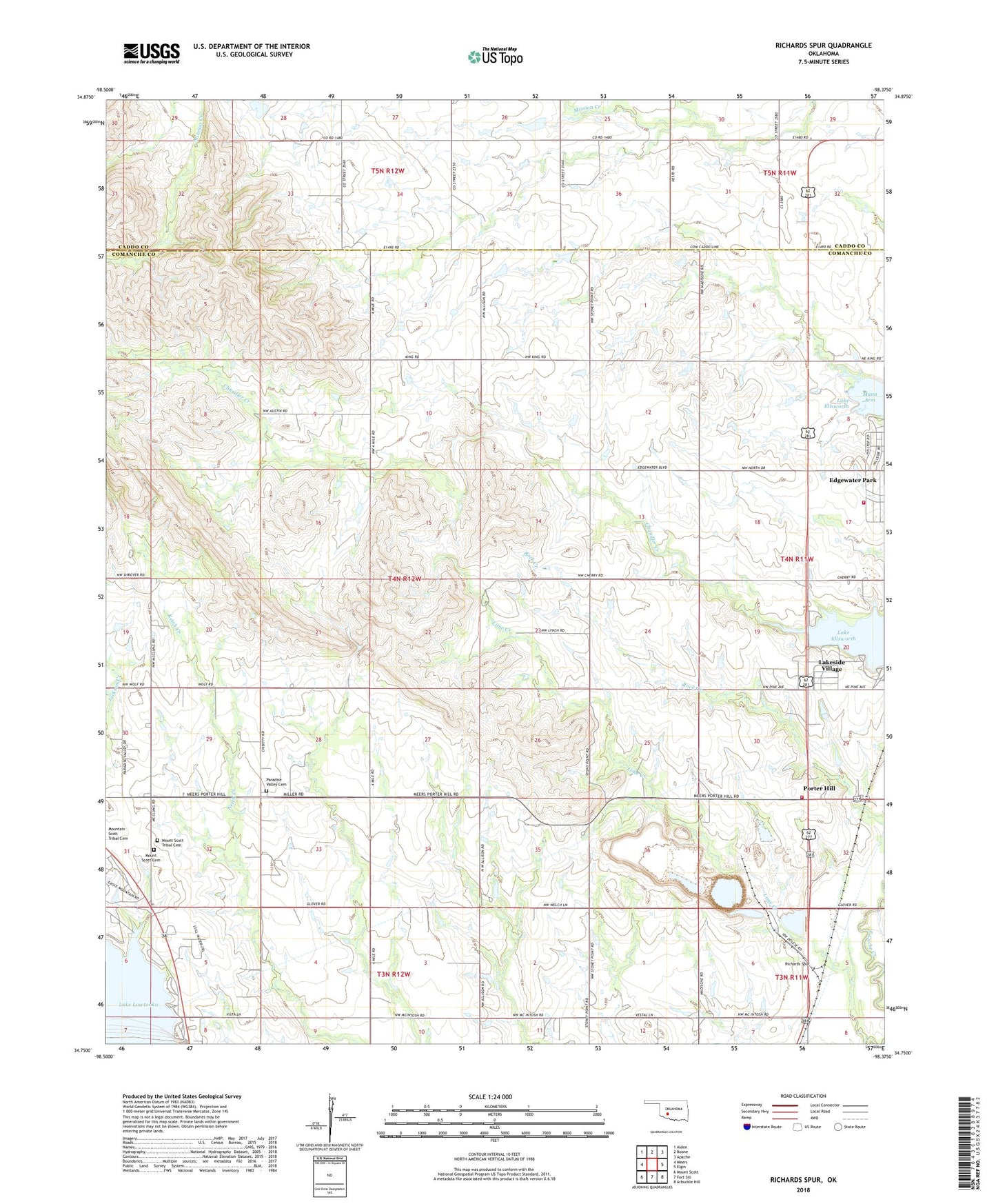
2022 topographic map quadrangle Richards Spur in the state of Oklahoma. Scale: 1:24000. Based on the newly updated USGS 7.5' US Topo map series, this map is in the following counties: Comanche, Caddo. The map contains contour data, water features, and other items you are used to seeing on USGS maps, but also has updated roads and other features. This is the next generation of topographic maps. Printed on high-quality waterproof paper with UV fade-resistant inks.
Quads adjacent to this one:
West: Meers
Northwest: Alden
North: Boone
Northeast: Apache
East: Elgin
Southeast: Arbuckle Hill
South: Fort Sill
Southwest: Mount Scott
This map covers the same area as the classic USGS quad with code o34098g4.
Contains the following named places: Chache Creek Mission, Chandler Creek, Edgewater Park, Edgewater Park Census Designated Place, Edgewater Park Volunteer Fire Department, Green Meadow Acres, Lakeside Village, Lakeside Village Census Designated Place, Leatherbury Landing Strip, Mount Scott Cemetery, Paradise Valley Cemetery, Paradise Valley Church, Porter Hill, Porter Hill Volunteer Fire Department, Richards Spur, Richards Spur Mission, Stony Point School, Township of Lake, White Wolf Ceremonial Grounds, Whitewolf Ceremonial Grounds