MyTopo
Apache Oklahoma US Topo Map
Couldn't load pickup availability
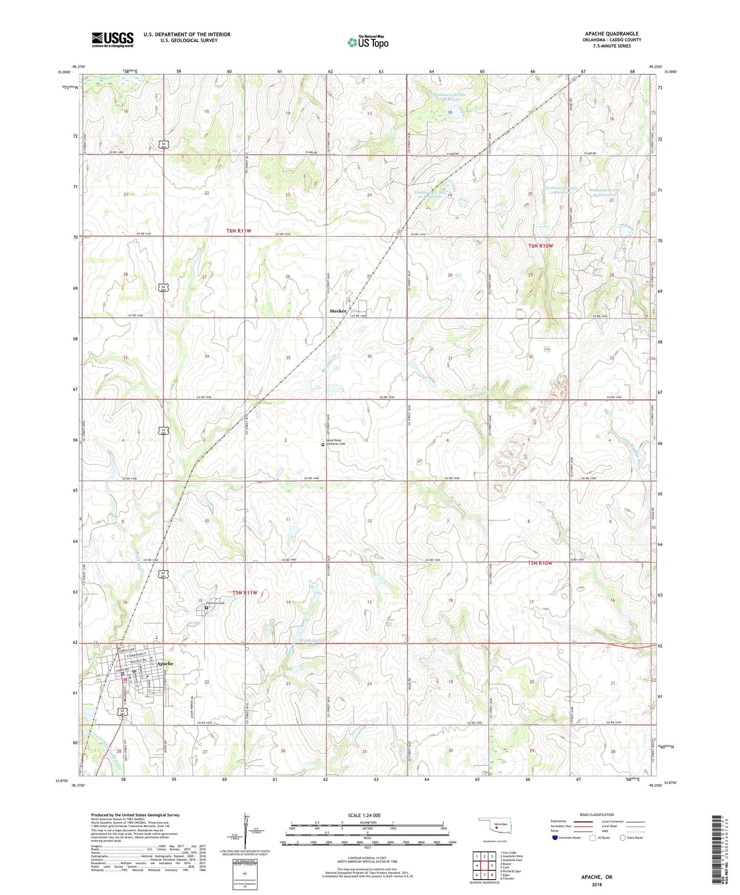
2022 topographic map quadrangle Apache in the state of Oklahoma. Scale: 1:24000. Based on the newly updated USGS 7.5' US Topo map series, this map is in the following counties: Caddo. The map contains contour data, water features, and other items you are used to seeing on USGS maps, but also has updated roads and other features. This is the next generation of topographic maps. Printed on high-quality waterproof paper with UV fade-resistant inks.
Quads adjacent to this one:
West: Boone
Northwest: Fort Cobb
North: Anadarko West
Northeast: Anadarko East
East: Cyril
Southeast: Fletcher
South: Elgin
Southwest: Richards Spur
This map covers the same area as the classic USGS quad with code o34098h3.
Contains the following named places: Apache, Apache Ambulance Service, Apache Elementary School, Apache Fire Department, Apache High School, Apache Middle School, Apache Police Department, Apache Post Office, Assembly of God Church, Fairview Cemetery, Fort Sill Apache Tribal Complex, Full Gospel Church, Huntley, Manar Landing Strip, Methvin Memorial Mission, Mission Creek, Pentecostal Church, Saint Peter Lutheran Cemetery, Stecker, Tonkawa Creek Site 10 Dam, Tonkawa Creek Site 10 Reservoir, Tonkawa Creek Site 2a Dam, Tonkawa Creek Site 2a Reservoir, Tonkawa Creek Site 3 Dam, Tonkawa Creek Site 3 Reservoir, Tonkawa Creek Site 6 Dam, Tonkawa Creek Site 6 Reservoir, Tonkawa Creek Site 7 Dam, Tonkawa Creek Site 7 Reservoir, Tonkawa Creek Site 9 Dam, Tonkawa Creek Site 9 Reservoir, Town of Apache, Township of Abilene, Township of Doyle, Township of Highland, Township of Tonkawa, Weidenmaier Lakes