MyTopo
Enterprise Oklahoma US Topo Map
Couldn't load pickup availability
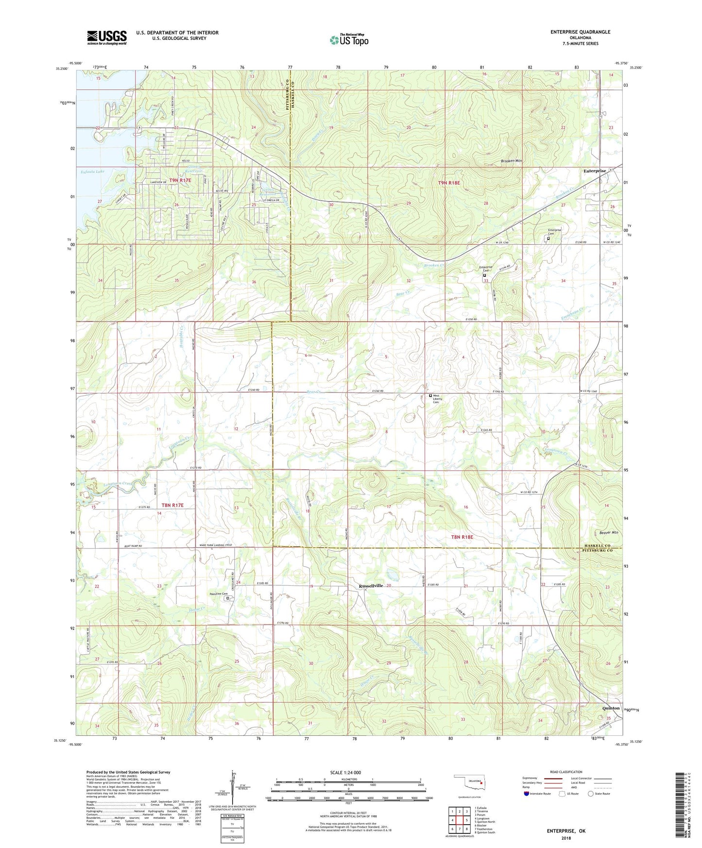
2018 topographic map quadrangle Enterprise in the state of Oklahoma. Scale: 1:24000. Based on the newly updated USGS 7.5' US Topo map series, this map is in the following counties: Pittsburg, Haskell. The map contains contour data, water features, and other items you are used to seeing on USGS maps, but also has updated roads and other features. This is the next generation of topographic maps. Printed on high-quality waterproof paper with UV fade-resistant inks.
Quads adjacent to this one:
West: Longtown
Northwest: Eufaula
North: Texanna
Northeast: Porum
East: Quinton North
Southeast: Quinton South
South: Featherston
Southwest: Blocker
Contains the following named places: Bear Creek, Brooken Mountain, Enterprise, Enterprise Cemetery, Enterprise Census Designated Place, Haytubbi Creek, Heifer Creek, Highway 9 Landing, House Creek, Oak Ridge Church, Oknoname 121003 Dam, Oknoname 121003 Reservoir, Oknoname 121015 Dam, Oknoname 121015 Reservoir, Palestine Cemetery, Palestine Church, Russellville, Russellville Branch, Township of Brooken, West Liberty Cemetery, West Liberty Church, ZIP Code: 74561