MyTopo
Texanna Oklahoma US Topo Map
Couldn't load pickup availability
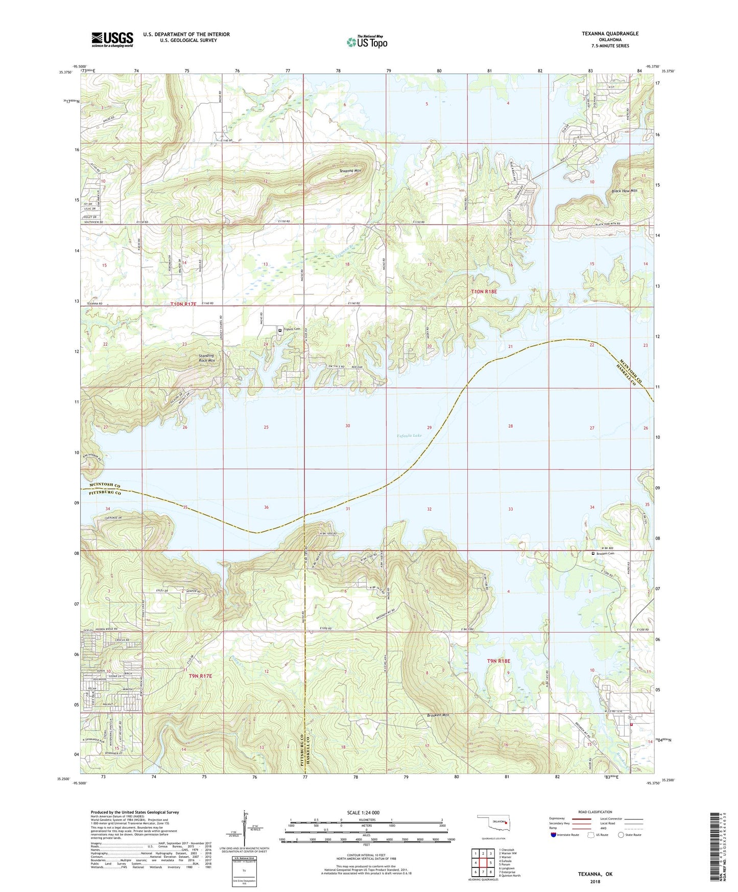
2022 topographic map quadrangle Texanna in the state of Oklahoma. Scale: 1:24000. Based on the newly updated USGS 7.5' US Topo map series, this map is in the following counties: McIntosh, Haskell, Pittsburg. The map contains contour data, water features, and other items you are used to seeing on USGS maps, but also has updated roads and other features. This is the next generation of topographic maps. Printed on high-quality waterproof paper with UV fade-resistant inks.
Quads adjacent to this one:
West: Eufaula
Northwest: Checotah
North: Warner NW
Northeast: Warner
East: Porum
Southeast: Quinton North
South: Enterprise
Southwest: Longtown
This map covers the same area as the classic USGS quad with code o35095c4.
Contains the following named places: Brooken Cemetery, Brooken Volunteer Fire Department, Duchess Creek, KWSQ-FM (Muskogee), Lindsey Chapel, Mud Creek, Oknoname 131007 Dam, Piney Creek, Standing Rock Mountain, Texanna, Texanna Branch, Texanna Mountain, Township of Cobb, Triplett Cemetery