MyTopo
Quinton South Oklahoma US Topo Map
Couldn't load pickup availability
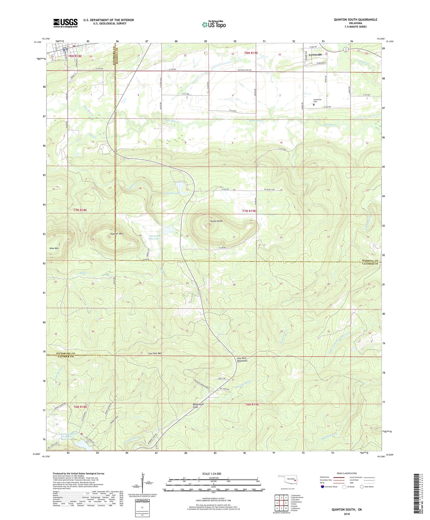
2022 topographic map quadrangle Quinton South in the state of Oklahoma. Scale: 1:24000. Based on the newly updated USGS 7.5' US Topo map series, this map is in the following counties: Latimer, Haskell, Pittsburg. The map contains contour data, water features, and other items you are used to seeing on USGS maps, but also has updated roads and other features. This is the next generation of topographic maps. Printed on high-quality waterproof paper with UV fade-resistant inks.
Quads adjacent to this one:
West: Featherston
Northwest: Enterprise
North: Quinton North
Northeast: Sans Bois
East: Kinta
Southeast: Panola
South: Wilburton
Southwest: Gowen
This map covers the same area as the classic USGS quad with code o35095a3.
Contains the following named places: Ash Creek Community Fire Department, Black Gum Flats, Coblentz Lake, Coblentz Lake Dam, Iron Post Mountain, Lewisville, Lewisville Cemetery, Mill Creek, Panther Mountain, Quinton, Quinton City Lake, Quinton Lake, Quinton Lake Dam, Quinton Police Department, Quinton Post Office, Quinton Volunteer Fire Department, Robbers Cave State Park, Rough Canyon, Shoe Mountain, Tucker Knob, Youth Camp Number 2