MyTopo
Faxon Oklahoma US Topo Map
Couldn't load pickup availability
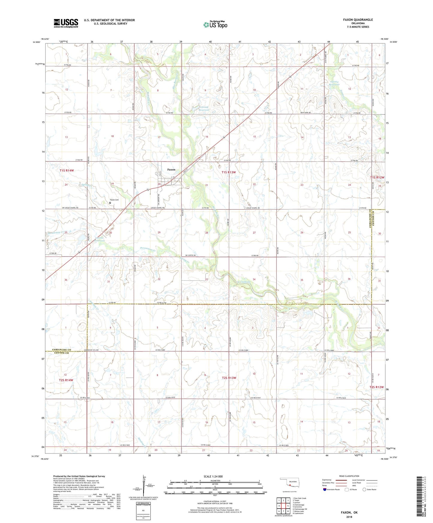
2022 topographic map quadrangle Faxon in the state of Oklahoma. Scale: 1:24000. Based on the newly updated USGS 7.5' US Topo map series, this map is in the following counties: Comanche, Cotton. The map contains contour data, water features, and other items you are used to seeing on USGS maps, but also has updated roads and other features. This is the next generation of topographic maps. Printed on high-quality waterproof paper with UV fade-resistant inks.
Quads adjacent to this one:
West: Chattanooga
Northwest: Post Oak Creek
North: Taupa
Northeast: Lawton
East: Geronimo
Southeast: Cookietown
South: Whites Lake
Southwest: Chattanooga SW
This map covers the same area as the classic USGS quad with code o34098d5.
Contains the following named places: Blue Beaver Creek, Faxon, Faxon Cemetery, Jack Creek Site 4 Dam, Jack Creek Site 4 Reservoir, Oknoname 031022 Dam, Oknoname 031022 Reservoir, Oknoname 031063 Dam, Oknoname 031063 Reservoir, Oknoname 031064 Dam, Oknoname 031064 Reservoir, Oknoname 031068 Dam, Oknoname 031068 Reservoir, Oknoname 031069 Dam, Persimmon Creek, Spring Creek, Town of Faxon, Township of Mangan, ZIP Code: 73540