MyTopo
Gage Oklahoma US Topo Map
Couldn't load pickup availability
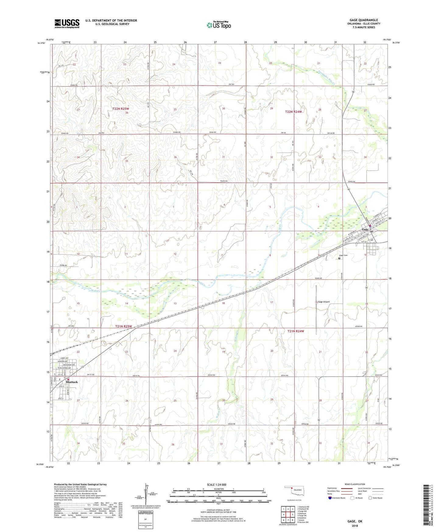
2022 topographic map quadrangle Gage in the state of Oklahoma. Scale: 1:24000. Based on the newly updated USGS 7.5' US Topo map series, this map is in the following counties: Ellis. The map contains contour data, water features, and other items you are used to seeing on USGS maps, but also has updated roads and other features. This is the next generation of topographic maps. Printed on high-quality waterproof paper with UV fade-resistant inks.
Quads adjacent to this one:
West: Shattuck
Northwest: Shattuck NW
North: Shattuck NE
Northeast: Fargo NW
East: Fargo SW
Southeast: Harmon NW
South: Arnett
Southwest: Goodwin
This map covers the same area as the classic USGS quad with code o36099c7.
Contains the following named places: Ebenezer Baptist Church, Ellis County Emergency Medical Services, First Christian Church, Gage, Gage Airport, Gage Army Air Field, Gage Cemetery, Gage Elementary School, Gage Fire Department, Gage High School, Gage Police Department, Gage Post Office, Shattuck Elementary School, Shattuck Fire Department, Town of Gage, Township of Rock, Willow Creek