MyTopo
Shattuck Oklahoma US Topo Map
Couldn't load pickup availability
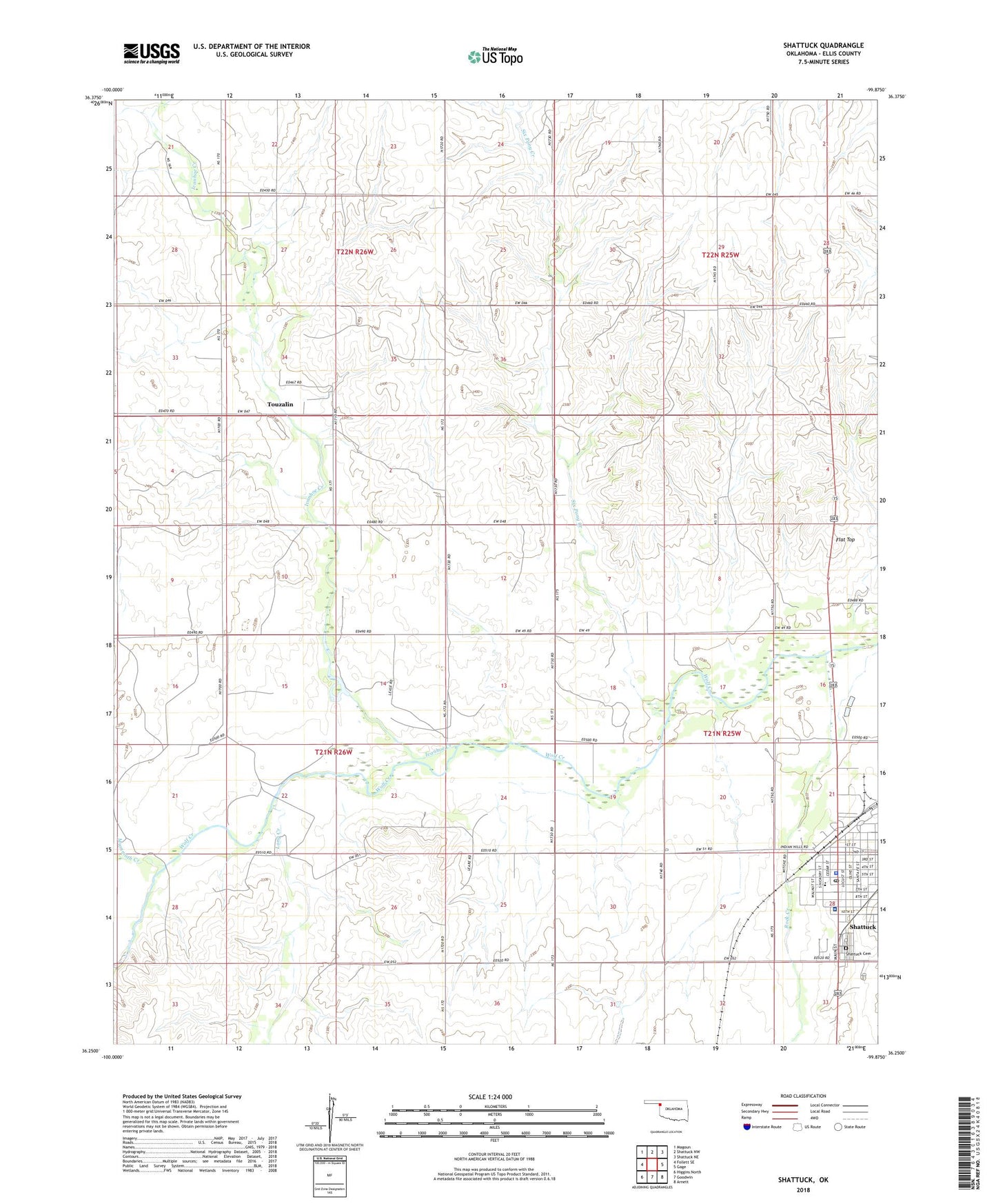
2022 topographic map quadrangle Shattuck in the state of Oklahoma. Scale: 1:24000. Based on the newly updated USGS 7.5' US Topo map series, this map is in the following counties: Ellis. The map contains contour data, water features, and other items you are used to seeing on USGS maps, but also has updated roads and other features. This is the next generation of topographic maps. Printed on high-quality waterproof paper with UV fade-resistant inks.
Quads adjacent to this one:
West: Follett SE
Northwest: Magoun
North: Shattuck NW
Northeast: Shattuck NE
East: Gage
Southeast: Arnett
South: Goodwin
Southwest: Higgins North
Contains the following named places: Assembly of God Church, Faith Church, First Baptist Church, First Christian Church, Flat Top, Ivanhoe Creek, Long Creek, Mammoth Creek, Newman Memorial Hospital, Rock Creek, Seventh Day Adventist Church, Shattuck, Shattuck Cemetery, Shattuck Hospital Heliport, Shattuck Police Department, Shattuck Post Office, Shattuck Senior High School, Six Pony Creek, Touzalin, Town of Shattuck, Township of Ivanhoe, United Methodist Church